Open ledger · AOD.EU.FLAINE.V00 · ORIGINALClose ledger · AOD.EU.FLAINE.V00
Ledger AOD.EU.FLAINE.V00
Flaine overview
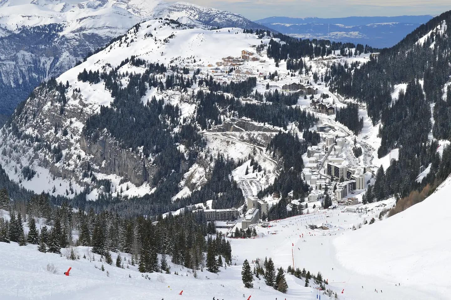
Overview of Flaine in Haute-Savoie, France, during winter sports season, with its neighborhoods Flaine Forum, Forêt, Montsoleil, and Le Hameau, seen from the ski slopes to the east of the town beneath Tête de Balacha. This photograph is used as a geographic witness to the place, not as evidence of the historical date shown in the chapter.
- Visual description
- Overview of Flaine in Haute-Savoie, France, during winter sports season, with its neighborhoods Flaine Forum, Forêt, Montsoleil, and Le Hameau, seen from the ski slopes to the east of the town beneath Tête de Balacha
- Nature
- original
- Medium
- Open-licence photograph
- Source
- Wikimedia Commons · CC0
BEFORE MODERN SPORT
Flaine
How settlement, access and winter sport shaped Flaine.
Scroll to read the contour through time
Flaine is a ski area in the Haute Savoie region of the French Alps, and is a part of the linked Grand Massif domain.
Sources for this chapter
BEFORE TOURISM
Work and settlement beneath the snowline
The upper area, Flaine Forêt, at an altitude of 1,700 metres (5,600 ft), consists of a number of apartment buildings named after constellations, the Éric et Sylvie Boissonnas Auditorium, shops, offices and restaurants.
Sources for this chapter
2006
A route reaches Flaine
For 2006, new gondola cabins were installed on Aup de Véran, whilst the base station was renovated for 2007.
Sources for this chapter
Open ledger · AOD.EU.FLAINE.V01 · ORIGINALClose ledger · AOD.EU.FLAINE.V01
Ledger AOD.EU.FLAINE.V01
Flaine
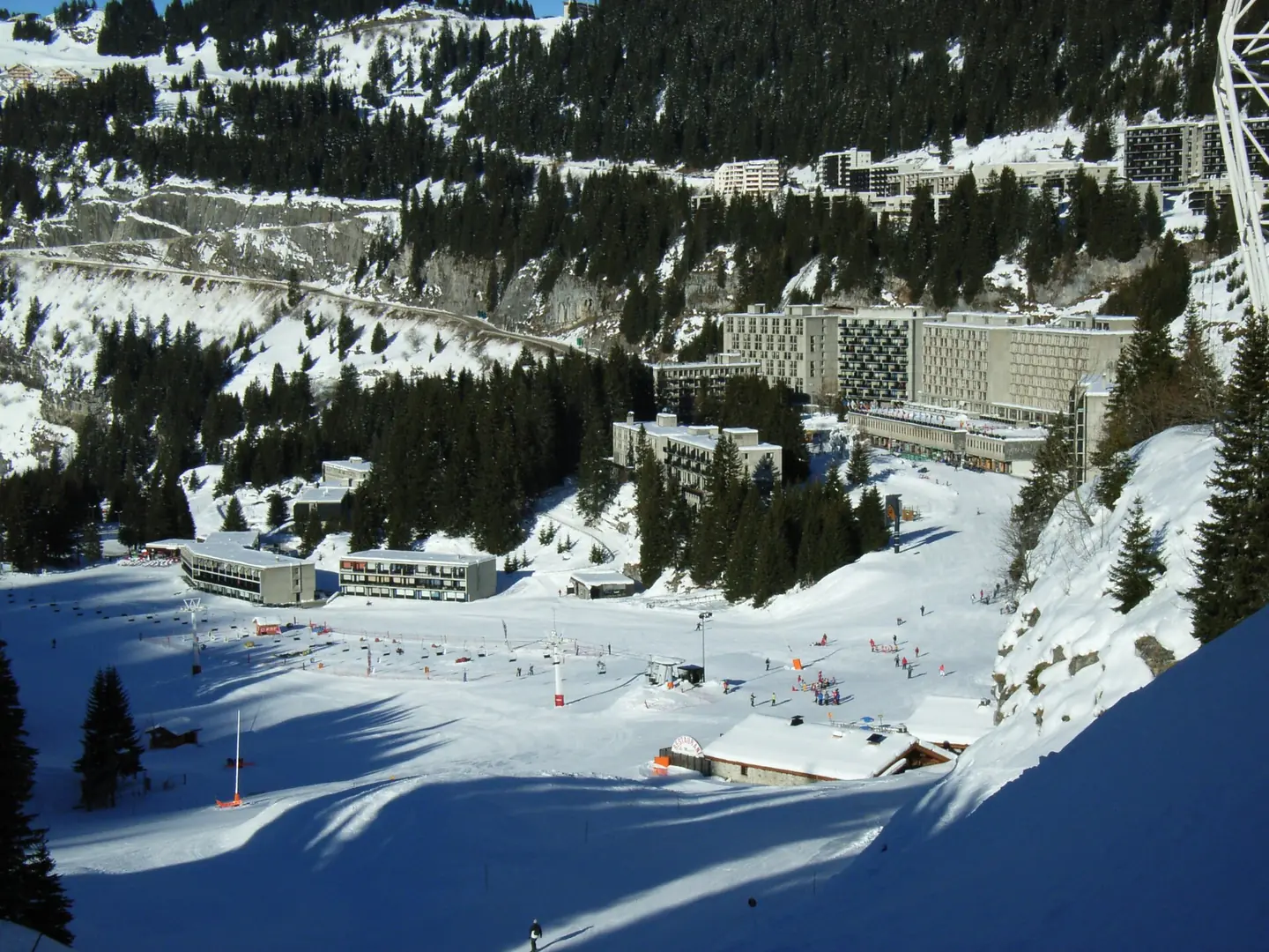
photo de la station de ski Flaine, prise le 11 janvier 2006 11h. This photograph is used as a geographic witness to the place, not as evidence of the historical date shown in the chapter.
- Visual description
- photo de la station de ski Flaine, prise le 11 janvier 2006 11h
- Nature
- original
- Medium
- Open-licence photograph
- Source
- Wikimedia Commons · CC BY 1.0
ORGANISED SPORT
Winter becomes organised
Flaine has been dubbed “the world's ugliest ski resort” due to the brutalist architecture of its buildings.
Sources for this chapter
THE LIVING MAP
The mapped place
Flaine is recorded at 46.006° N, 6.691° E. Its catalogue reference reaches 2,500 metres. A modern resort map compresses terrain, exposure and access into a diagram. This exhibition keeps the underlying contour visible so the place does not become only a list of facilities.
Sources for this chapter
Open ledger · AOD.EU.FLAINE.V00 · ORIGINALClose ledger · AOD.EU.FLAINE.V00
Ledger AOD.EU.FLAINE.V00
Flaine overview
Overview of Flaine in Haute-Savoie, France, during winter sports season, with its neighborhoods Flaine Forum, Forêt, Montsoleil, and Le Hameau, seen from the ski slopes to the east of the town beneath Tête de Balacha. This photograph is used as a geographic witness to the place, not as evidence of the historical date shown in the chapter.
- Visual description
- Overview of Flaine in Haute-Savoie, France, during winter sports season, with its neighborhoods Flaine Forum, Forêt, Montsoleil, and Le Hameau, seen from the ski slopes to the east of the town beneath Tête de Balacha
- Nature
- original
- Medium
- Open-licence photograph
- Source
- Wikimedia Commons · CC0
TODAY
Flaine now
The result was a three-year delay and huge cost overruns, and led to greater state involvement in French ski resort development.
Sources for this chapter
THE LEDGER
Sources and credits
This exhibition is built from local, institutional and sporting records. The source ledger keeps the claims visible and leaves space for correction as further local evidence emerges.
Sources for this chapter
Artefacts in order of appearance
Flaine overview
AOD.EU.FLAINE.V00 · original · Wikimedia Commons · CC0
Flaine
AOD.EU.FLAINE.V01 · original · Wikimedia Commons · CC BY 1.0
Editorial record
Full European Beta edition. Place evidence is adapted from the linked Flaine overview under CC BY-SA 4.0 and remains subject to named historical and local review. Cartography is generated from the PeakWave location catalogue.