Open ledger · AOD.UK.EXE-ESTUARY.V00 · ORIGINALClose ledger · AOD.UK.EXE-ESTUARY.V00
Ledger AOD.UK.EXE-ESTUARY.V00
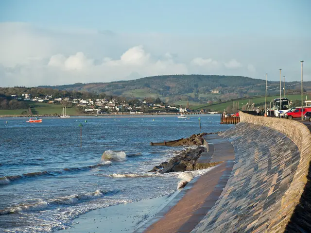
Across the Exe estuary towards Starcross
Across the Exe estuary towards Starcross. This photograph is used as a geographic witness to the place, not as evidence of the historical date shown in the chapter.
- Visual description
- Across the Exe estuary towards Starcross
- Nature
- original
- Medium
- Open-licence photograph
- Source
- Wikimedia Commons / Geograph · CC BY-SA 2.0
- Reviewed
- Josh Wildman
THE ESTUARY
Exe Estuary
A tidal Devon river where clubs learned to race around channels, banks and a moving bar.
Scroll to read the water through time
The Exe narrows from broad upper reaches towards a shifting entrance at Exmouth.
Sandbanks and strong tidal flow make the course change hour by hour.
Sources for this chapter
WORKING WATER
Ports before starting lines
Communities around the Exe used the river for trade, fishing and passage before organised sport.
Sailing inherited their need to recognise channels, shallows and the timing of the tide.
Sources for this chapter
1872
A club begins at Exmouth
Exe Sailing Club traces its history to 1872.
A permanent organisation turned local sailing into repeatable racing, training and social life at the mouth of the river.
Sources for this chapter
Open ledger · AOD.UK.EXE-ESTUARY.V01 · ORIGINALClose ledger · AOD.UK.EXE-ESTUARY.V01
Ledger AOD.UK.EXE-ESTUARY.V01
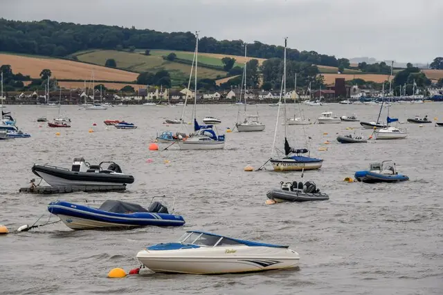
Exmouth , River Exe Estuary
Exmouth : River Exe Estuary. This photograph is used as a geographic witness to the place, not as evidence of the historical date shown in the chapter.
- Visual description
- Exmouth : River Exe Estuary
- Nature
- original
- Medium
- Open-licence photograph
- Source
- Wikimedia Commons / Geograph · CC BY-SA 2.0
- Reviewed
- Josh Wildman
THE 20th CENTURY
Different reaches, different racing
Clubs and classes spread around the estuary.
Dinghies could race in sheltered reaches while cruisers used the lower river and sea, giving one estuary several sporting identities.
Sources for this chapter
THE LIVING MAP
The mapped place
Exe Estuary is recorded at 50.620° N, 3.430° W as an estuary venue. A course drawn here is temporary: wind, current, shore and marks determine the water that sailors actually meet.
Sources for this chapter
Open ledger · AOD.UK.EXE-ESTUARY.V00 · ORIGINALClose ledger · AOD.UK.EXE-ESTUARY.V00
Ledger AOD.UK.EXE-ESTUARY.V00
Across the Exe estuary towards Starcross
Across the Exe estuary towards Starcross. This photograph is used as a geographic witness to the place, not as evidence of the historical date shown in the chapter.
- Visual description
- Across the Exe estuary towards Starcross
- Nature
- original
- Medium
- Open-licence photograph
- Source
- Wikimedia Commons / Geograph · CC BY-SA 2.0
- Reviewed
- Josh Wildman
TODAY
The tide still writes the timetable
The Exe remains a busy recreational waterway used for club sailing, cruising and instruction.
Events and departures still begin with the tide table rather than the clock alone.
Sources for this chapter
THE LEDGER
Sources and credits
This exhibition is built from local, institutional and sporting records. The source ledger keeps the claims visible and leaves space for correction as further local evidence emerges.
Sources for this chapter
Artefacts in order of appearance
Across the Exe estuary towards Starcross
AOD.UK.EXE-ESTUARY.V00 · original · Wikimedia Commons / Geograph · CC BY-SA 2.0
Exmouth , River Exe Estuary
AOD.UK.EXE-ESTUARY.V01 · original · Wikimedia Commons / Geograph · CC BY-SA 2.0
Editorial record
Full UK edition. Historical claims are linked to the local, public and sporting records used to write the exhibition. Cartography is generated from the PeakWave location catalogue.