Open ledger · AOD.EU.EASKEY.V00 · ORIGINALClose ledger · AOD.EU.EASKEY.V00
Ledger AOD.EU.EASKEY.V00
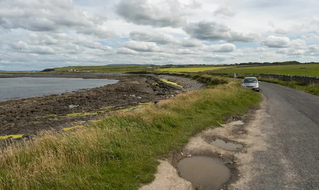
Coastal road at Pollnagat near Easkey - geograph.org.uk - 7839874
Coastal road at Pollnagat near Easkey. This photograph is used as a geographic witness to the place, not as evidence of the historical date shown in the chapter.
- Visual description
- Coastal road at Pollnagat near Easkey
- Nature
- original
- Medium
- Open-licence photograph
- Source
- Wikimedia Commons · CC BY-SA 2.0
BEFORE MODERN SPORT
Easkey
How work, access and surfing shaped Easkey.
Scroll to follow the shoreline through time
Easky or Easkey (; Irish: Iascaigh, meaning 'abounding in fish') is a village in County Sligo, Ireland.
Sources for this chapter
1888
Work at the water’s edge
In the centre of Easkey village is the Old Abbey and graveyard which dates back to medieval times and remained in use until 1888, when Roslea Cemetery was opened.
Sources for this chapter
ACCESS CHANGES
The shore becomes reachable
The surviving overview does not identify one decisive access date for Easkey.
This edition therefore leaves that date open rather than turning gradual change into a false single event.
Sources for this chapter
![Coast at Easky Pier [1]](/_next/image?url=%2Fmuseum%2Fplaces%2Feurope%2Feaskey-activity.webp&w=3840&q=75&dpl=dpl_5gChhG62kWbBad8hNgQJaHVVtwCA)
Open ledger · AOD.EU.EASKEY.V01 · ORIGINALClose ledger · AOD.EU.EASKEY.V01
Ledger AOD.EU.EASKEY.V01
Coast at Easky Pier (1) - geograph.org.uk - 5518980
Coast at Easky Pier [1]. This photograph is used as a geographic witness to the place, not as evidence of the historical date shown in the chapter.
- Visual description
- Coast at Easky Pier [1]
- Nature
- original
- Medium
- Open-licence photograph
- Source
- Wikimedia Commons · CC BY-SA 2.0
1995
Surfing reads the same coast differently
In 1995 the Irish Surfing Association established its headquarters in the Easky Surf and Information Centre on Main Street.
Sources for this chapter
THE LIVING MAP
The mapped place
Easkey is recorded at 54.298° N, 8.948° W. A surf map fixes a name to one stretch of moving water, but the place changes with tide, swell direction, wind and the shape of the seabed.
Sources for this chapter
Open ledger · AOD.EU.EASKEY.V00 · ORIGINALClose ledger · AOD.EU.EASKEY.V00
Ledger AOD.EU.EASKEY.V00
Coastal road at Pollnagat near Easkey - geograph.org.uk - 7839874
Coastal road at Pollnagat near Easkey. This photograph is used as a geographic witness to the place, not as evidence of the historical date shown in the chapter.
- Visual description
- Coastal road at Pollnagat near Easkey
- Nature
- original
- Medium
- Open-licence photograph
- Source
- Wikimedia Commons · CC BY-SA 2.0
TODAY
Easkey now
Easky is known for its surfing areas, including two reef breaks.
Sources for this chapter
THE LEDGER
Sources and credits
This exhibition is built from local, institutional and sporting records. The source ledger keeps the claims visible and leaves space for correction as further local evidence emerges.
Sources for this chapter
Artefacts in order of appearance
Coastal road at Pollnagat near Easkey - geograph.org.uk - 7839874
AOD.EU.EASKEY.V00 · original · Wikimedia Commons · CC BY-SA 2.0
Coast at Easky Pier (1) - geograph.org.uk - 5518980
AOD.EU.EASKEY.V01 · original · Wikimedia Commons · CC BY-SA 2.0
Editorial record
Full European Beta edition. Place evidence is adapted from the linked Easky overview under CC BY-SA 4.0 and remains subject to named historical and local review. Cartography is generated from the PeakWave location catalogue.