![The harbour in Kingstown [now Dún Laoghaire], Co. Dublin, Ireland, in about 1895. Photochrom print](/_next/image?url=%2Fmuseum%2Fplaces%2Feurope%2Fdun-laoghaire-place.webp&w=3840&q=75&dpl=dpl_5gChhG62kWbBad8hNgQJaHVVtwCA)
Open ledger · AOD.EU.DUN-LAOGHAIRE.V00 · ORIGINALClose ledger · AOD.EU.DUN-LAOGHAIRE.V00
Ledger AOD.EU.DUN-LAOGHAIRE.V00
The harbour in Kingstown, Co. Dublin, Ireland, in about 1895 - Option 2
The harbour in Kingstown [now Dún Laoghaire], Co. Dublin, Ireland, in about 1895. Photochrom print. This photograph is used as a geographic witness to the place, not as evidence of the historical date shown in the chapter.
- Visual description
- The harbour in Kingstown [now Dún Laoghaire], Co. Dublin, Ireland, in about 1895. Photochrom print
- Nature
- original
- Medium
- Open-licence photograph
- Source
- Wikimedia Commons · Public domain
BEFORE MODERN SPORT
Dun Laoghaire
How working water, access and organised sailing shaped Dun Laoghaire.
Scroll to read the water through time
Dún Laoghaire is a suburban coastal town on the southside of Dublin, Ireland.
Sources for this chapter
1816
A working shore
The town was built up alongside a small existing settlement following 1816 legislation that allowed the building of a major port to serve Dublin.
Sources for this chapter
1834
The route to the water
Ireland's first railway, covering the five and a half miles from Dublin (Westland Row station) to Kingstown was opened on 17 December 1834.
Sources for this chapter
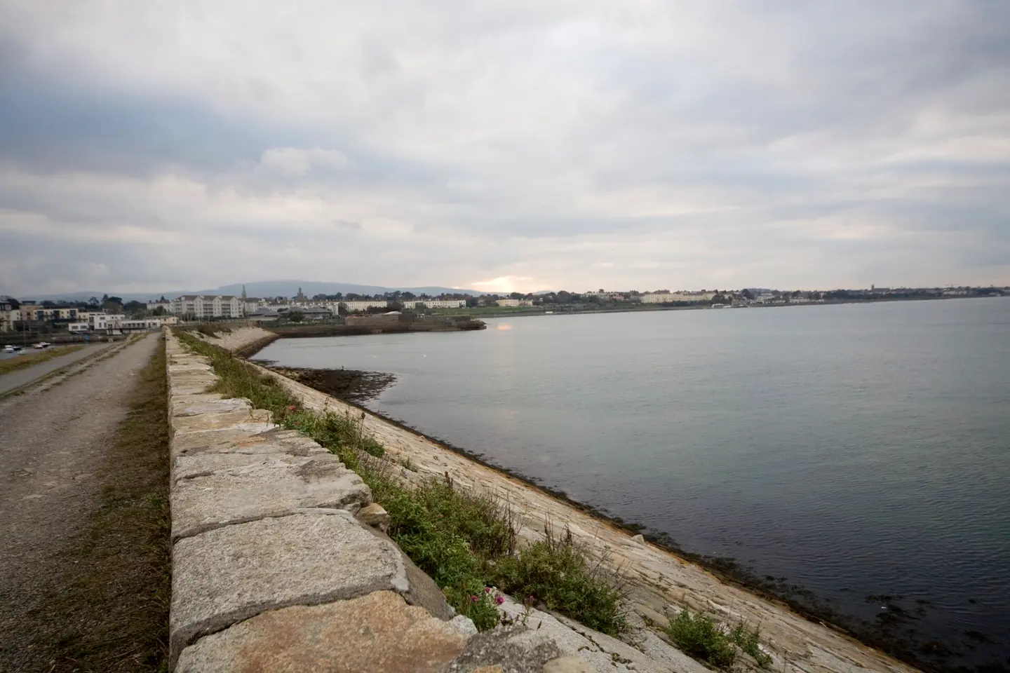
Open ledger · AOD.EU.DUN-LAOGHAIRE.V01 · ORIGINALClose ledger · AOD.EU.DUN-LAOGHAIRE.V01
Ledger AOD.EU.DUN-LAOGHAIRE.V01
West Pier - Dun Laoghaire Harbour (Ireland)
West Pier - Dun Laoghaire Harbour (Ireland). This photograph is used as a geographic witness to the place, not as evidence of the historical date shown in the chapter.
- Visual description
- West Pier - Dun Laoghaire Harbour (Ireland)
- Nature
- original
- Medium
- Open-licence photograph
- Source
- Wikimedia Commons · CC BY-SA 2.0
ORGANISED SPORT
Sailing becomes organised
Dún Laoghaire harbour is home to a number of yacht clubs of which Dublin Bay Sailing Club incorporating the Royal Alfred yacht Club is the largest.
It organises racing for dinghies and keelboats on Tuesdays, Wednesdays, Thursdays and Saturdays from April to September.
Sources for this chapter
THE LIVING MAP
The mapped place
Dun Laoghaire is recorded at 53.290° N, 6.130° W as a coastal open venue. A course drawn here is temporary: wind, current, shore and marks determine the water that sailors actually meet.
Sources for this chapter
Open ledger · AOD.EU.DUN-LAOGHAIRE.V00 · ORIGINALClose ledger · AOD.EU.DUN-LAOGHAIRE.V00
Ledger AOD.EU.DUN-LAOGHAIRE.V00
The harbour in Kingstown, Co. Dublin, Ireland, in about 1895 - Option 2
The harbour in Kingstown [now Dún Laoghaire], Co. Dublin, Ireland, in about 1895. Photochrom print. This photograph is used as a geographic witness to the place, not as evidence of the historical date shown in the chapter.
- Visual description
- The harbour in Kingstown [now Dún Laoghaire], Co. Dublin, Ireland, in about 1895. Photochrom print
- Nature
- original
- Medium
- Open-licence photograph
- Source
- Wikimedia Commons · Public domain
TODAY
Dun Laoghaire now
The 820-berth marina is the largest in the country, and opened in 2001 following resistance for over 15 years by a group led by the late John de Courcy Ireland, the maritime historian.
Sources for this chapter
THE LEDGER
Sources and credits
This exhibition is built from local, institutional and sporting records. The source ledger keeps the claims visible and leaves space for correction as further local evidence emerges.
Sources for this chapter
Artefacts in order of appearance
The harbour in Kingstown, Co. Dublin, Ireland, in about 1895 - Option 2
AOD.EU.DUN-LAOGHAIRE.V00 · original · Wikimedia Commons · Public domain
West Pier - Dun Laoghaire Harbour (Ireland)
AOD.EU.DUN-LAOGHAIRE.V01 · original · Wikimedia Commons · CC BY-SA 2.0
Editorial record
Full European Beta edition. Place evidence is adapted from the linked Dún Laoghaire overview under CC BY-SA 4.0 and remains subject to named historical and local review. Cartography is generated from the PeakWave location catalogue.