Open ledger · AOD.EU.COURMAYEUR.V00 · ORIGINALClose ledger · AOD.EU.COURMAYEUR.V00
Ledger AOD.EU.COURMAYEUR.V00
Courmayeur
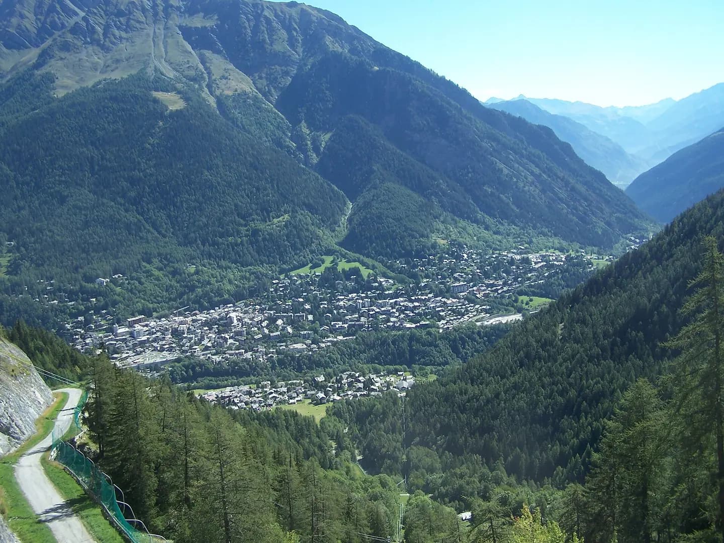
view on Courmayeur, Aosta valley, Italy. This photograph is used as a geographic witness to the place, not as evidence of the historical date shown in the chapter.
- Visual description
- view on Courmayeur, Aosta valley, Italy
- Nature
- original
- Medium
- Open-licence photograph
- Source
- Wikimedia Commons · CC BY-SA 3.0
BEFORE MODERN SPORT
Courmayeur
How settlement, access and winter sport shaped Courmayeur.
Scroll to read the contour through time
Courmayeur (French: , Italian: ; Valdôtain: Croméyeui) is a town and comune in northern Italy, in the autonomous region of Aosta Valley, serving as one of the two bases on either side of Mont Blanc, Europe's highest mountain.
Sources for this chapter
2013
Work and settlement beneath the snowline
In 2013, in accordance with regional law 61 (Dénomination officielle des communes de la Vallée d'Aoste et protection de la toponymie locale), a referendum was carried out to change the official name to Courmayeur-Mont-Blanc, but there was insufficient support.
Sources for this chapter
1965
A route reaches Courmayeur
The Mont Blanc Tunnel, connecting Courmayeur with Chamonix, opened in 1965, and provides an important road link between Italy and France.
Sources for this chapter
Open ledger · AOD.EU.COURMAYEUR.V01 · ORIGINALClose ledger · AOD.EU.COURMAYEUR.V01
Ledger AOD.EU.COURMAYEUR.V01
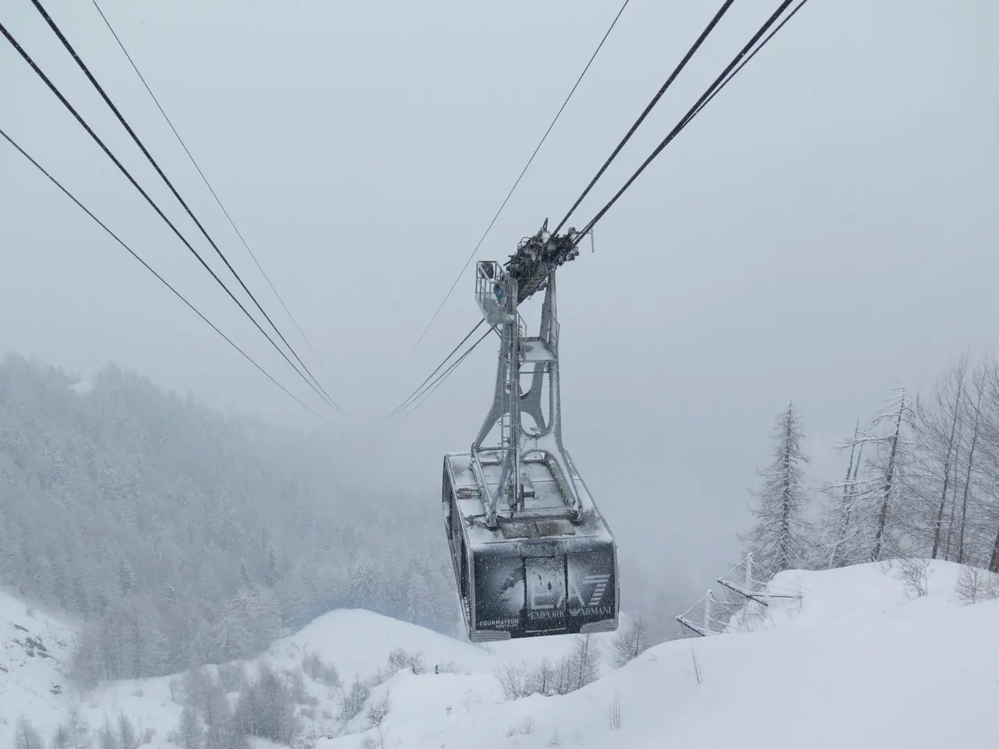
The Courmayeur Cable Car
500px provided description: The cable car coming out of the mists to take us off the mountain at the Courmayeur ski resort in Italy. This photograph is used as a geographic witness to the place, not as evidence of the historical date shown in the chapter.
- Visual description
- 500px provided description: The cable car coming out of the mists to take us off the mountain at the Courmayeur ski resort in Italy
- Nature
- original
- Medium
- Open-licence photograph
- Source
- Wikimedia Commons · CC BY 3.0
ORGANISED SPORT
Winter becomes organised
Courmayeur is cited as "Italy's best all-round ski resort", and contains the Alpine Botanical Garden Saussurea, which describes itself as Europe's highest botanical garden.
Sources for this chapter
THE LIVING MAP
The mapped place
Courmayeur is recorded at 45.797° N, 6.972° E. Its catalogue reference reaches 2,755 metres. A modern resort map compresses terrain, exposure and access into a diagram. This exhibition keeps the underlying contour visible so the place does not become only a list of facilities.
Sources for this chapter
Open ledger · AOD.EU.COURMAYEUR.V00 · ORIGINALClose ledger · AOD.EU.COURMAYEUR.V00
Ledger AOD.EU.COURMAYEUR.V00
Courmayeur
view on Courmayeur, Aosta valley, Italy. This photograph is used as a geographic witness to the place, not as evidence of the historical date shown in the chapter.
- Visual description
- view on Courmayeur, Aosta valley, Italy
- Nature
- original
- Medium
- Open-licence photograph
- Source
- Wikimedia Commons · CC BY-SA 3.0
TODAY
Courmayeur now
Courmayeur also shares access to the glacial ski run of the Vallée Blanche with another French town, Chamonix, which sits at the opposite, northern, side of the Mont Blanc massif.
Sources for this chapter
THE LEDGER
Sources and credits
This exhibition is built from local, institutional and sporting records. The source ledger keeps the claims visible and leaves space for correction as further local evidence emerges.
Sources for this chapter
Artefacts in order of appearance
Courmayeur
AOD.EU.COURMAYEUR.V00 · original · Wikimedia Commons · CC BY-SA 3.0
The Courmayeur Cable Car
AOD.EU.COURMAYEUR.V01 · original · Wikimedia Commons · CC BY 3.0
Editorial record
Full European Beta edition. Place evidence is adapted from the linked Courmayeur overview under CC BY-SA 4.0 and remains subject to named historical and local review. Cartography is generated from the PeakWave location catalogue.