
Open ledger · AOD.EU.CORTINA-DAMPEZZO.V00 · ORIGINALClose ledger · AOD.EU.CORTINA-DAMPEZZO.V00
Ledger AOD.EU.CORTINA-DAMPEZZO.V00
Cortina d'Ampezzo, Italy 1956
Cortina d'Ampezzo, Italy 1956. This photograph is used as a geographic witness to the place, not as evidence of the historical date shown in the chapter.
- Visual description
- Cortina d'Ampezzo, Italy 1956
- Nature
- original
- Medium
- Open-licence photograph
- Source
- Wikimedia Commons · Public domain
BEFORE MODERN SPORT
Cortina d'Ampezzo
How settlement, access and winter sport shaped Cortina d'Ampezzo.
Scroll to read the contour through time
Cortina d'Ampezzo (Italian: ; local Ladin: Anpezo, elsewhere Ampëz; historical Austrian German: Hayden), often abbreviated to Cortina, is a town and comune (municipality) in the province of Belluno, in the Veneto region of Northern Italy.
Sources for this chapter
1508
Work and settlement beneath the snowline
From 1508, it then spent much of its history under Habsburg rule, briefly undergoing some territorial changes under Napoleon, before being returned to the Austrian Empire (later Austria-Hungary), which held it until 1918.
Sources for this chapter
1956
A route reaches Cortina d'Ampezzo
The Cortina Airport was built for the 1956 Winter Olympics, but is currently closed.
Sources for this chapter
Open ledger · AOD.EU.CORTINA-DAMPEZZO.V01 · ORIGINALClose ledger · AOD.EU.CORTINA-DAMPEZZO.V01
Ledger AOD.EU.CORTINA-DAMPEZZO.V01
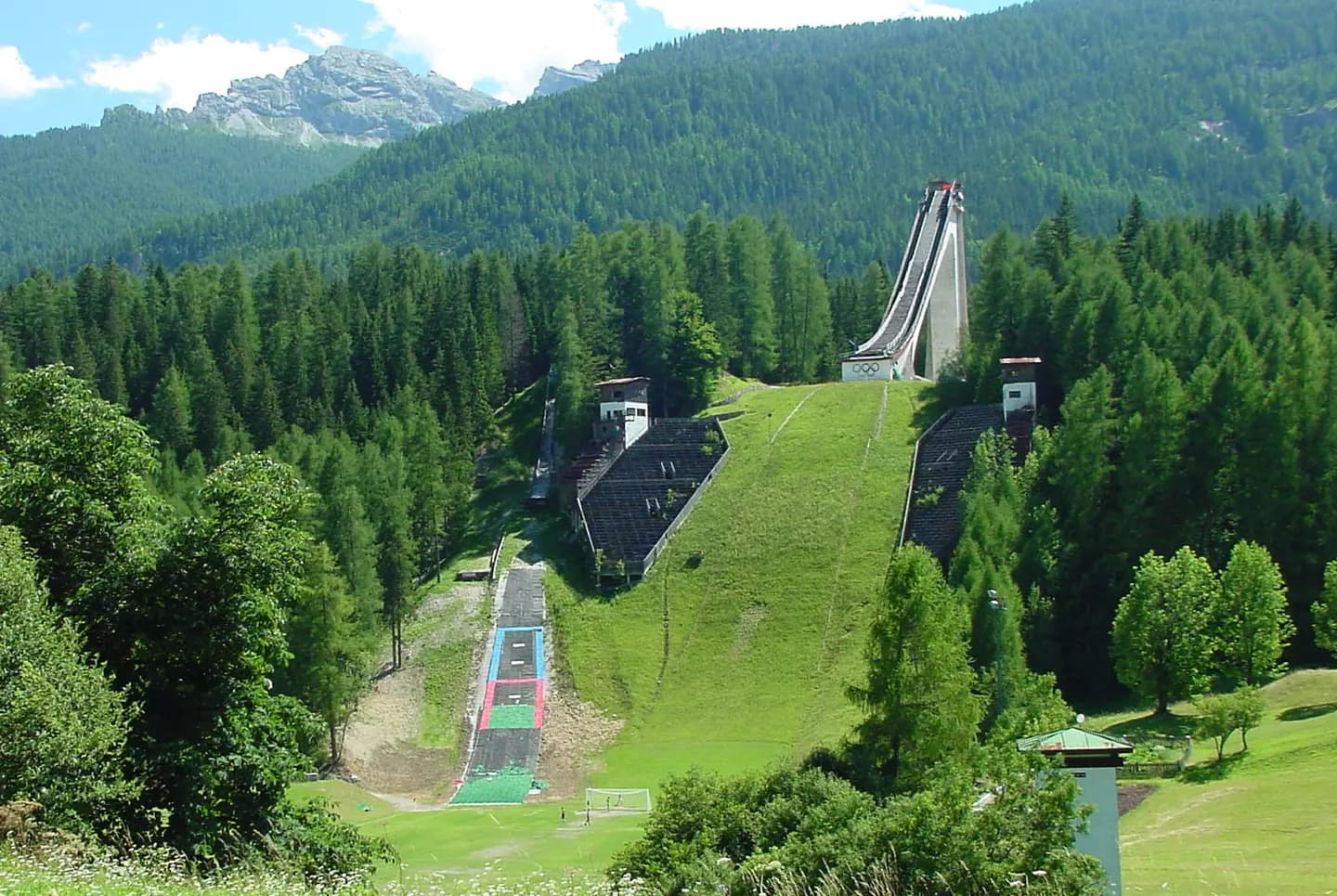
Olympic-Ski-Jumping-hill-Cortina
in Cortina d'Ampezzo (Trampolino Olimpico Italia). Site of the Nordic Ski Jumping competitions during the 1956 Winter Olympics (NH K90 - NC K90/15). This photograph is used as a geographic witness to the place, not as evidence of the historical date shown in the chapter.
- Visual description
- in Cortina d'Ampezzo (Trampolino Olimpico Italia). Site of the Nordic Ski Jumping competitions during the 1956 Winter Olympics (NH K90 - NC K90/15)
- Nature
- original
- Medium
- Open-licence photograph
- Source
- Wikimedia Commons · CC BY 3.0
ORGANISED SPORT
Winter becomes organised
Situated on the Boite river, in an alpine valley in the heart of the southern Dolomitic Alps, it is an upscale summer and winter sport resort known for its skiing trails, scenery, accommodation, shops and its jet-set-dominated après-ski scene.
Sources for this chapter
THE LIVING MAP
The mapped place
Cortina d'Ampezzo is recorded at 46.537° N, 12.136° E. Its catalogue reference reaches 2,932 metres. A modern resort map compresses terrain, exposure and access into a diagram. This exhibition keeps the underlying contour visible so the place does not become only a list of facilities.
Sources for this chapter
Open ledger · AOD.EU.CORTINA-DAMPEZZO.V00 · ORIGINALClose ledger · AOD.EU.CORTINA-DAMPEZZO.V00
Ledger AOD.EU.CORTINA-DAMPEZZO.V00
Cortina d'Ampezzo, Italy 1956
Cortina d'Ampezzo, Italy 1956. This photograph is used as a geographic witness to the place, not as evidence of the historical date shown in the chapter.
- Visual description
- Cortina d'Ampezzo, Italy 1956
- Nature
- original
- Medium
- Open-licence photograph
- Source
- Wikimedia Commons · Public domain
TODAY
Cortina d'Ampezzo now
With the Forcella Staunies (currently not in operation) and the Forcella Rossa, the ski area has one of the steepest slopes in the Dolomites.
Sources for this chapter
THE LEDGER
Sources and credits
This exhibition is built from local, institutional and sporting records. The source ledger keeps the claims visible and leaves space for correction as further local evidence emerges.
Sources for this chapter
Artefacts in order of appearance
Cortina d'Ampezzo, Italy 1956
AOD.EU.CORTINA-DAMPEZZO.V00 · original · Wikimedia Commons · Public domain
Olympic-Ski-Jumping-hill-Cortina
AOD.EU.CORTINA-DAMPEZZO.V01 · original · Wikimedia Commons · CC BY 3.0
Editorial record
Full European Beta edition. Place evidence is adapted from the linked Cortina d'Ampezzo overview under CC BY-SA 4.0 and remains subject to named historical and local review. Cartography is generated from the PeakWave location catalogue.