Open ledger · AOD.US.COLUMBIA-GORGE.V00 · ORIGINALClose ledger · AOD.US.COLUMBIA-GORGE.V00
Ledger AOD.US.COLUMBIA-GORGE.V00
Hood river
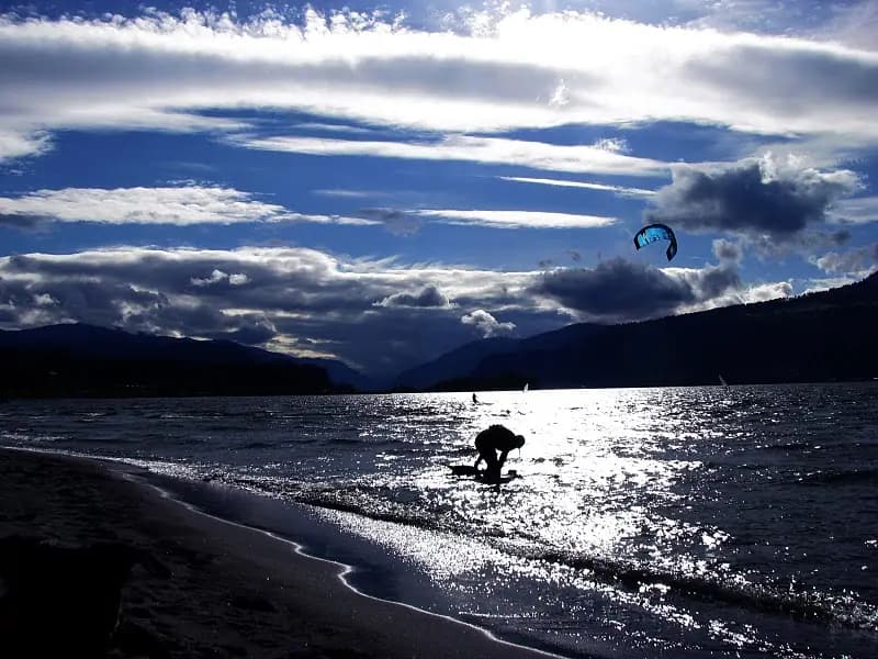
Sun set at hood river, Columbia river. This photograph is used as a geographic witness to the place, not as evidence of the historical date shown in the chapter.
- Visual description
- Sun set at hood river, Columbia river
- Nature
- original
- Medium
- Open-licence photograph
- Source
- Wikimedia Commons · CC BY-SA 3.0
BEFORE MODERN SPORT
Columbia River Gorge
How working water, access and organised sailing shaped Columbia River Gorge.
Scroll to read the water through time
The Columbia River Gorge is a canyon of the Columbia River in the Pacific Northwest of the United States.
Sources for this chapter
1957
A working shore
Shipping was greatly simplified after Bonneville Dam and The Dalles Dam submerged the gorge's major rapids such as Celilo Falls, a major salmon fishing site for local Native Americans until the site's submergence in 1957.
Sources for this chapter
ACCESS CHANGES
The route to the water
Route 30, Washington State Route 14, and railroad tracks on both sides run through the gorge.
Open ledger · AOD.US.COLUMBIA-GORGE.V01 · ORIGINALClose ledger · AOD.US.COLUMBIA-GORGE.V01
Ledger AOD.US.COLUMBIA-GORGE.V01
Columbia River Windsurfer (Hood River County, Oregon scenic images)
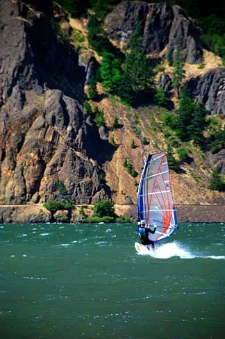
A windsurfer on the Columbia River at Viento State Park. This photograph is used as a geographic witness to the place, not as evidence of the historical date shown in the chapter.
- Visual description
- A windsurfer on the Columbia River at Viento State Park
- Nature
- original
- Medium
- Open-licence photograph
- Source
- Wikimedia Commons · Attribution
1979
Sailing becomes organised
Windsurfers began using the Gorge in 1979.
By the mid-1980s, its opposing river current and summer winds had made it an international wind-sport destination.
THE LIVING MAP
The mapped place
Columbia River Gorge is recorded at 45.700° N, 121.800° W as an inland venue. A course drawn here is temporary: wind, current, shore and marks determine the water that sailors actually meet.
Sources for this chapter
Open ledger · AOD.US.COLUMBIA-GORGE.V00 · ORIGINALClose ledger · AOD.US.COLUMBIA-GORGE.V00
Ledger AOD.US.COLUMBIA-GORGE.V00
Hood river
Sun set at hood river, Columbia river. This photograph is used as a geographic witness to the place, not as evidence of the historical date shown in the chapter.
- Visual description
- Sun set at hood river, Columbia river
- Nature
- original
- Medium
- Open-licence photograph
- Source
- Wikimedia Commons · CC BY-SA 3.0
TODAY
Columbia River Gorge now
The Columbia River Gorge remains a protected national scenic area, transport corridor and wind-sport destination shared by communities in Oregon and Washington.
THE LEDGER
Sources and credits
This exhibition is built from local, institutional and sporting records. The source ledger keeps the claims visible and leaves space for correction as further local evidence emerges.
Sources for this chapter
Artefacts in order of appearance
Hood river
AOD.US.COLUMBIA-GORGE.V00 · original · Wikimedia Commons · CC BY-SA 3.0
Columbia River Windsurfer (Hood River County, Oregon scenic images)
AOD.US.COLUMBIA-GORGE.V01 · original · Wikimedia Commons · Attribution
Editorial record
Full US Beta edition. Place evidence is adapted from the linked Columbia River Gorge overview under CC BY-SA 4.0 and remains subject to named historical and local review. Cartography is generated from the PeakWave location catalogue.