Open ledger · AOD.UK.CHICHESTER-HARBOUR.V00 · ORIGINALClose ledger · AOD.UK.CHICHESTER-HARBOUR.V00
Ledger AOD.UK.CHICHESTER-HARBOUR.V00
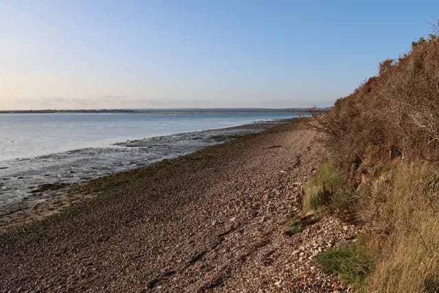
Foreshore of Chichester Harbour
Foreshore of Chichester Harbour. This photograph is used as a geographic witness to the place, not as evidence of the historical date shown in the chapter.
- Visual description
- Foreshore of Chichester Harbour
- Nature
- original
- Medium
- Open-licence photograph
- Source
- Wikimedia Commons / Geograph · CC BY-SA 2.0
- Reviewed
- Josh Wildman
THE NATURAL HARBOUR
Chichester Harbour
From working creeks and fishing races to one of Britain’s busiest sailing landscapes.
Scroll to read the water through time
Chichester Harbour is a branching tidal system, not a single open bay.
Mudflats, channels and low peninsulas create many small sailing grounds whose usable shape changes with the tide.
Sources for this chapter
THE 19th CENTURY
Fishing boats race
Informal fishing-boat races were recorded in the nineteenth century.
Competition grew from working craft already adapted to the harbour, before yachting became a separate leisure culture.
Sources for this chapter
EDWARDIAN YEARS–1945
Clubs spread around the shore
Edwardian sailing drew wealthier visitors, then clubs multiplied after the First World War.
Each creek and village developed its own access point, fleet and relationship with the water.
Sources for this chapter
Open ledger · AOD.UK.CHICHESTER-HARBOUR.V01 · ORIGINALClose ledger · AOD.UK.CHICHESTER-HARBOUR.V01
Ledger AOD.UK.CHICHESTER-HARBOUR.V01
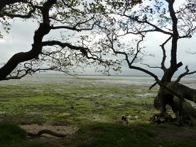
Chichester Harbour mudflats near Rookwood
Chichester Harbour mudflats near Rookwood. This photograph is used as a geographic witness to the place, not as evidence of the historical date shown in the chapter.
- Visual description
- Chichester Harbour mudflats near Rookwood
- Nature
- original
- Medium
- Open-licence photograph
- Source
- Wikimedia Commons / Geograph · CC BY-SA 2.0
- Reviewed
- Josh Wildman
1945–1971
Small boats widen participation
After 1945, greater mobility and cheaper boat construction brought many more sailors to the harbour.
The Conservancy created by the 1971 Act gave the crowded water a single body for navigation and conservation.
THE LIVING MAP
The mapped place
Chichester Harbour is recorded at 50.790° N, 0.890° W as an estuary venue. A course drawn here is temporary: wind, current, shore and marks determine the water that sailors actually meet.
Sources for this chapter
Open ledger · AOD.UK.CHICHESTER-HARBOUR.V00 · ORIGINALClose ledger · AOD.UK.CHICHESTER-HARBOUR.V00
Ledger AOD.UK.CHICHESTER-HARBOUR.V00
Foreshore of Chichester Harbour
Foreshore of Chichester Harbour. This photograph is used as a geographic witness to the place, not as evidence of the historical date shown in the chapter.
- Visual description
- Foreshore of Chichester Harbour
- Nature
- original
- Medium
- Open-licence photograph
- Source
- Wikimedia Commons / Geograph · CC BY-SA 2.0
- Reviewed
- Josh Wildman
TODAY
A sailing ground and protected landscape
The harbour now carries racing, cruising and training alongside wildlife protection and commercial navigation.
Its success depends on keeping a heavily used sailing landscape recognisably tidal and alive.
Sources for this chapter
THE LEDGER
Sources and credits
This exhibition is built from local, institutional and sporting records. The source ledger keeps the claims visible and leaves space for correction as further local evidence emerges.
Sources for this chapter
Artefacts in order of appearance
Foreshore of Chichester Harbour
AOD.UK.CHICHESTER-HARBOUR.V00 · original · Wikimedia Commons / Geograph · CC BY-SA 2.0
Chichester Harbour mudflats near Rookwood
AOD.UK.CHICHESTER-HARBOUR.V01 · original · Wikimedia Commons / Geograph · CC BY-SA 2.0
Editorial record
Full UK edition. Historical claims are linked to the local, public and sporting records used to write the exhibition. Cartography is generated from the PeakWave location catalogue.