Open ledger · AOD.EU.CAUTERETS.V00 · ORIGINALClose ledger · AOD.EU.CAUTERETS.V00
Ledger AOD.EU.CAUTERETS.V00
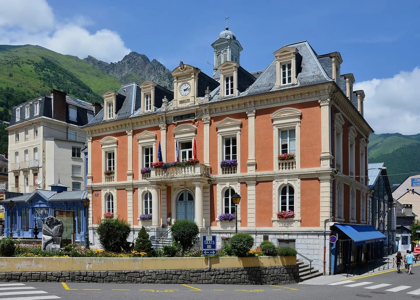
Cauterets 65 Hôtel de ville Vue SE 2014
Town hall of Cauterets, Hautes-Pyrénées, France. This photograph is used as a geographic witness to the place, not as evidence of the historical date shown in the chapter.
- Visual description
- Town hall of Cauterets, Hautes-Pyrénées, France
- Nature
- original
- Medium
- Open-licence photograph
- Source
- Wikimedia Commons · CC BY-SA 3.0
BEFORE MODERN SPORT
Cauterets
How settlement, access and winter sport shaped Cauterets.
Scroll to read the contour through time
Cauterets is a spa town, a ski resort and a commune in the Hautes-Pyrénées department and the region of Occitanie in south-western France.
Sources for this chapter
1901
Work and settlement beneath the snowline
Inaugurated in 1901, the old railway station of Cauterets was included in the title of historic monuments in 1981 for its façades and roofs.
Sources for this chapter
2005
A route reaches Cauterets
A new cable car was built in 2005 which can transport 2000 skiers per hour to the Cirque du Lys area.
Sources for this chapter
Open ledger · AOD.EU.CAUTERETS.V01 · ORIGINALClose ledger · AOD.EU.CAUTERETS.V01
Ledger AOD.EU.CAUTERETS.V01
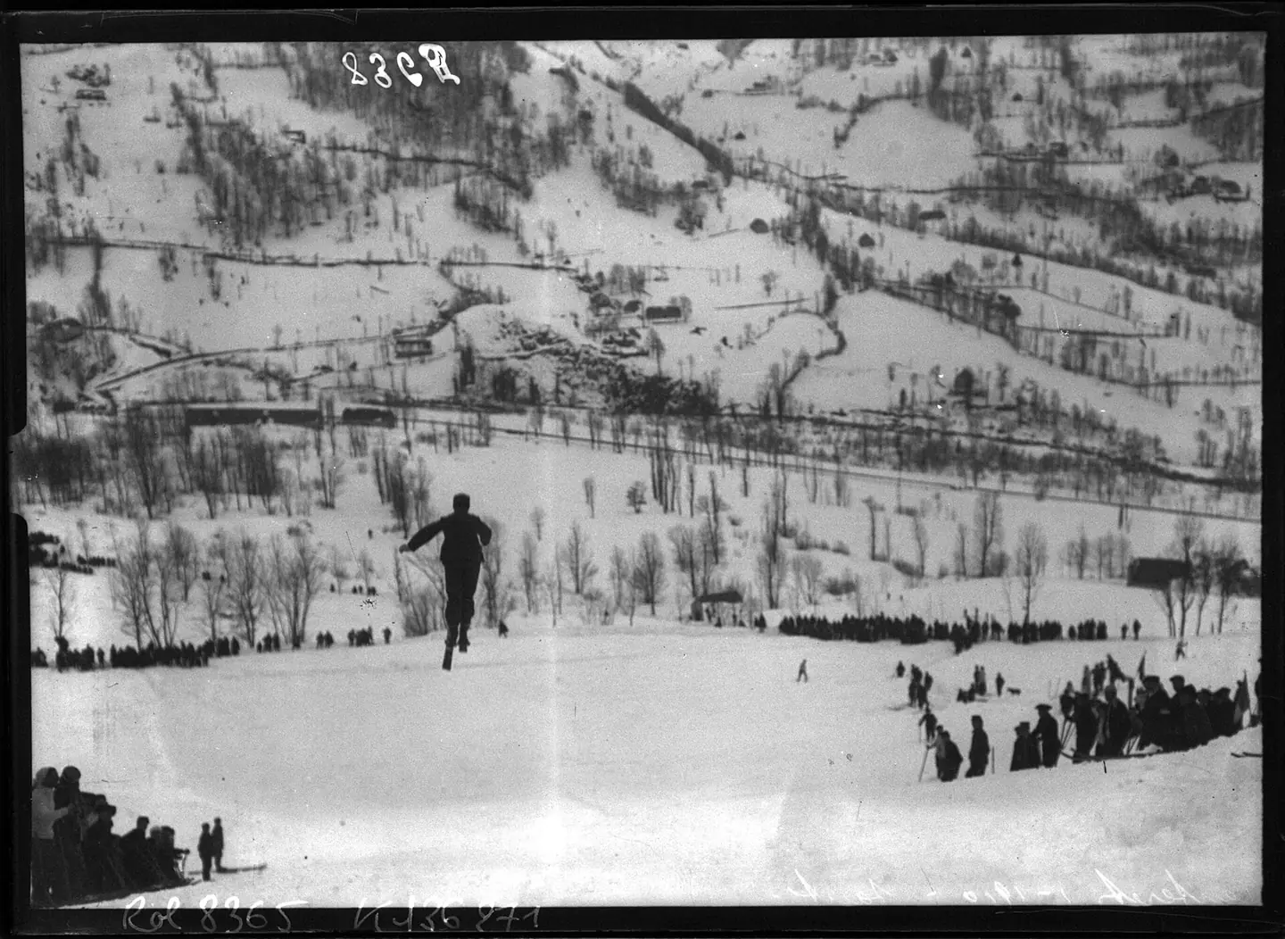
Cauterets (Hautes-Pyrénées), 1-1910, saut (à skis, Grande semaine des Pyrénées, du 24 au 27 janvier) - btv1b6913474r
Cauterets (Hautes-Pyrénées), 1-1910, saut (à skis, Grande semaine des Pyrénées, du 24 au 27 janvier) - btv1b6913474r. This photograph is used as a geographic witness to the place, not as evidence of the historical date shown in the chapter.
- Visual description
- Cauterets (Hautes-Pyrénées), 1-1910, saut (à skis, Grande semaine des Pyrénées, du 24 au 27 janvier) - btv1b6913474r
- Nature
- original
- Medium
- Open-licence photograph
- Source
- Wikimedia Commons · Public domain
2013
Winter becomes organised
In February 2013, Cauterets experienced a record snowfall, making it the snowiest resort in the world ahead of Mammoth Mountain with 5.5 metres (18 ft) at the ski resort.
Sources for this chapter
THE LIVING MAP
The mapped place
Cauterets is recorded at 42.882° N, 0.123° W. Its catalogue reference reaches 2,350 metres. A modern resort map compresses terrain, exposure and access into a diagram. This exhibition keeps the underlying contour visible so the place does not become only a list of facilities.
Sources for this chapter
Open ledger · AOD.EU.CAUTERETS.V00 · ORIGINALClose ledger · AOD.EU.CAUTERETS.V00
Ledger AOD.EU.CAUTERETS.V00
Cauterets 65 Hôtel de ville Vue SE 2014
Town hall of Cauterets, Hautes-Pyrénées, France. This photograph is used as a geographic witness to the place, not as evidence of the historical date shown in the chapter.
- Visual description
- Town hall of Cauterets, Hautes-Pyrénées, France
- Nature
- original
- Medium
- Open-licence photograph
- Source
- Wikimedia Commons · CC BY-SA 3.0
TODAY
Cauterets now
With Henri Sallenave and Louis Robach, he made the first ascents of the Vignemale and the Aneto on ski.
Sources for this chapter
THE LEDGER
Sources and credits
This exhibition is built from local, institutional and sporting records. The source ledger keeps the claims visible and leaves space for correction as further local evidence emerges.
Sources for this chapter
Artefacts in order of appearance
Cauterets 65 Hôtel de ville Vue SE 2014
AOD.EU.CAUTERETS.V00 · original · Wikimedia Commons · CC BY-SA 3.0
Cauterets (Hautes-Pyrénées), 1-1910, saut (à skis, Grande semaine des Pyrénées, du 24 au 27 janvier) - btv1b6913474r
AOD.EU.CAUTERETS.V01 · original · Wikimedia Commons · Public domain
Editorial record
Full European Beta edition. Place evidence is adapted from the linked Cauterets overview under CC BY-SA 4.0 and remains subject to named historical and local review. Cartography is generated from the PeakWave location catalogue.