Open ledger · AOD.UK.BURNHAM-ON-CROUCH.V00 · ORIGINALClose ledger · AOD.UK.BURNHAM-ON-CROUCH.V00
Ledger AOD.UK.BURNHAM-ON-CROUCH.V00
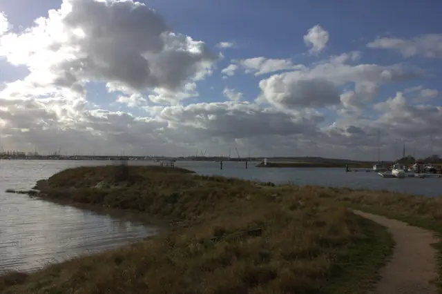
Burnham on Crouch marina entrance east side
Burnham on Crouch marina entrance east side. This photograph is used as a geographic witness to the place, not as evidence of the historical date shown in the chapter.
- Visual description
- Burnham on Crouch marina entrance east side
- Nature
- original
- Medium
- Open-licence photograph
- Source
- Wikimedia Commons / Geograph · CC BY-SA 2.0
- Reviewed
- Josh Wildman
BEFORE THE REGATTA
Burnham-on-Crouch
How an Essex river town built one of Britain’s enduring regatta traditions.
Scroll to read the water through time
Burnham developed on a tidal river where mudbanks, a narrow navigable channel and open estuary weather demand local knowledge.
The same geography that shaped working boats later produced close, tactical racing.
Sources for this chapter
1892–1895
Clubs arrive on the river
The Crouch Yacht Club arrived in 1892 and the Burnham Yacht Club followed in 1895.
Their growth turned an established river town into a meeting place for organised yacht racing.
Sources for this chapter
1893
The clubs race together
An inter-club regatta in 1893 supplied the pattern for Burnham Week: several organisations sharing one river and one programme rather than a single club owning the occasion.
Sources for this chapter
Open ledger · AOD.UK.BURNHAM-ON-CROUCH.V01 · ORIGINALClose ledger · AOD.UK.BURNHAM-ON-CROUCH.V01
Ledger AOD.UK.BURNHAM-ON-CROUCH.V01
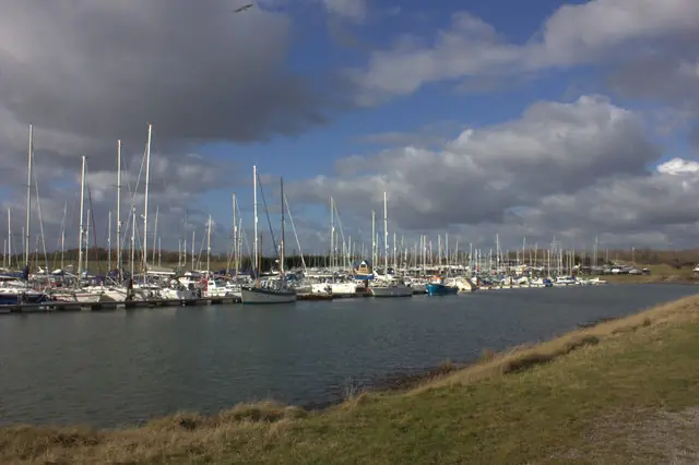
Burnham on Crouch marina
Burnham on Crouch marina. This photograph is used as a geographic witness to the place, not as evidence of the historical date shown in the chapter.
- Visual description
- Burnham on Crouch marina
- Nature
- original
- Medium
- Open-licence photograph
- Source
- Wikimedia Commons / Geograph · CC BY-SA 2.0
- Reviewed
- Josh Wildman
1930
A working people’s club
Burnham Sailing Club was established in 1930 with a more local, accessible character.
It widened the town’s sailing story beyond large yachts and formal clubhouses.
Sources for this chapter
THE LIVING MAP
The mapped place
Burnham-on-Crouch is recorded at 51.630° N, 0.810° E as an estuary venue. A course drawn here is temporary: wind, current, shore and marks determine the water that sailors actually meet.
Sources for this chapter
Open ledger · AOD.UK.BURNHAM-ON-CROUCH.V00 · ORIGINALClose ledger · AOD.UK.BURNHAM-ON-CROUCH.V00
Ledger AOD.UK.BURNHAM-ON-CROUCH.V00
Burnham on Crouch marina entrance east side
Burnham on Crouch marina entrance east side. This photograph is used as a geographic witness to the place, not as evidence of the historical date shown in the chapter.
- Visual description
- Burnham on Crouch marina entrance east side
- Nature
- original
- Medium
- Open-licence photograph
- Source
- Wikimedia Commons / Geograph · CC BY-SA 2.0
- Reviewed
- Josh Wildman
TODAY
A river still organised around racing
Burnham remains a place where regular club racing and the annual regatta make the river legible to newcomers.
Its identity comes from continuity between clubs, volunteers and a demanding tidal course.
Sources for this chapter
THE LEDGER
Sources and credits
This exhibition is built from local, institutional and sporting records. The source ledger keeps the claims visible and leaves space for correction as further local evidence emerges.
Sources for this chapter
Artefacts in order of appearance
Burnham on Crouch marina entrance east side
AOD.UK.BURNHAM-ON-CROUCH.V00 · original · Wikimedia Commons / Geograph · CC BY-SA 2.0
Burnham on Crouch marina
AOD.UK.BURNHAM-ON-CROUCH.V01 · original · Wikimedia Commons / Geograph · CC BY-SA 2.0
Editorial record
Full UK edition. Historical claims are linked to the local, public and sporting records used to write the exhibition. Cartography is generated from the PeakWave location catalogue.