Open ledger · AOD.UK.BRIMMS-NESS.V00 · ORIGINALClose ledger · AOD.UK.BRIMMS-NESS.V00
Ledger AOD.UK.BRIMMS-NESS.V00
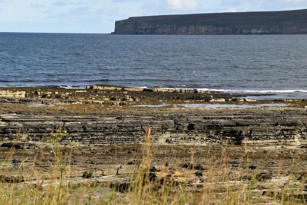
Caithness Flagstone Wave Cut Platform
Caithness Flagstone Wave Cut Platform. This photograph is used as a geographic witness to the place, not as evidence of the historical date shown in the chapter.
- Visual description
- Caithness Flagstone Wave Cut Platform
- Nature
- original
- Medium
- Open-licence photograph
- Source
- Wikimedia Commons / Geograph · CC BY-SA 2.0
- Reviewed
- Josh Wildman
THE HEADLAND
Brimms Ness
A Caithness headland where ancient settlement and modern reef surfing occupy the same exposed edge.
Scroll to follow the shoreline through time
Brims Ness is low, rocky Caithness coast facing water accelerated around Scotland’s northern edge.
Reef shelves shape the breaking waves and leave little room for error.
Sources for this chapter
ANCIENT CAITHNESS
A coast crowded with older remains
The surrounding landscape preserves brochs, cairns, castles and traces of long settlement.
The headland was never empty simply because its modern surf history is recent.
Sources for this chapter
LATE 20th CENTURY
Cold-water equipment opens the reef
Better wetsuits and road-borne boards made sustained surfing on the north coast possible.
Exploration spread outward from the better-known beaches and Thurso’s competition scene.
Sources for this chapter
Open ledger · AOD.UK.BRIMMS-NESS.V01 · ORIGINALClose ledger · AOD.UK.BRIMMS-NESS.V01
Ledger AOD.UK.BRIMMS-NESS.V01
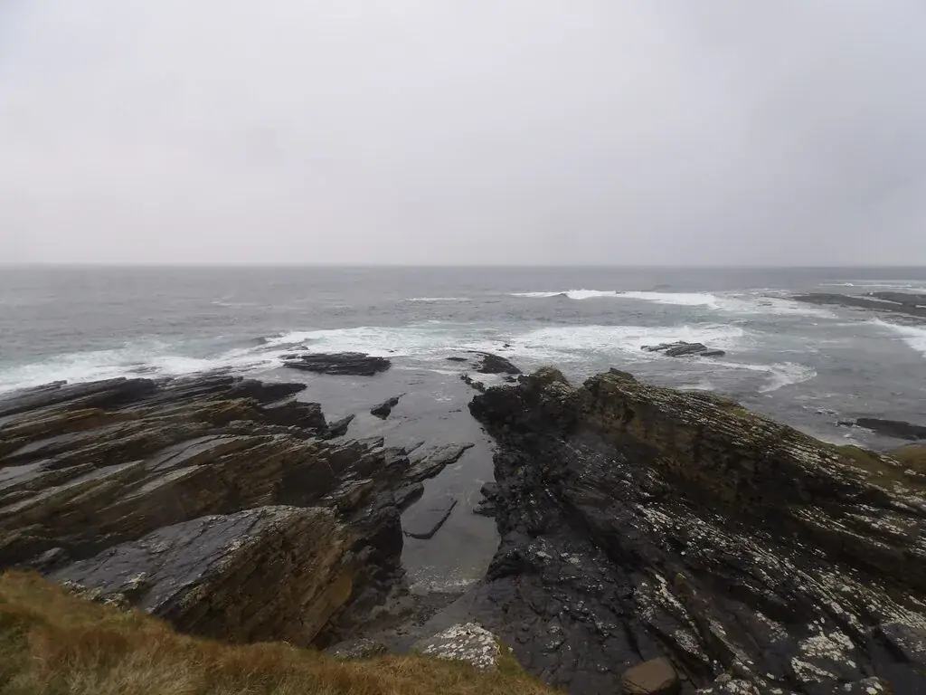
Whale's Back, Brims Ness
Whale's Back, Brims Ness. This photograph is used as a geographic witness to the place, not as evidence of the historical date shown in the chapter.
- Visual description
- Whale's Back, Brims Ness
- Nature
- original
- Medium
- Open-licence photograph
- Source
- Wikimedia Commons / Geograph · CC BY-SA 2.0
- Reviewed
- Josh Wildman
THE REEF BREAK
A wave without a grandstand
Brims became part of the Caithness surf map as an exposed reef rather than a resort beach.
Its reputation depends on precise conditions, local knowledge and a careful rock entry.
Sources for this chapter
THE LIVING MAP
The mapped place
Brimms Ness is recorded at 58.623° N, 3.415° W. A surf map fixes a name to one stretch of moving water, but the place changes with tide, swell direction, wind and the shape of the seabed.
Sources for this chapter
Open ledger · AOD.UK.BRIMMS-NESS.V00 · ORIGINALClose ledger · AOD.UK.BRIMMS-NESS.V00
Ledger AOD.UK.BRIMMS-NESS.V00
Caithness Flagstone Wave Cut Platform
Caithness Flagstone Wave Cut Platform. This photograph is used as a geographic witness to the place, not as evidence of the historical date shown in the chapter.
- Visual description
- Caithness Flagstone Wave Cut Platform
- Nature
- original
- Medium
- Open-licence photograph
- Source
- Wikimedia Commons / Geograph · CC BY-SA 2.0
- Reviewed
- Josh Wildman
TODAY
Exposure is the identity
Brims Ness remains a serious cold-water location rather than a mass participation beach.
The same exposure that produces its waves also keeps safety, access and respect for the headland central.
Sources for this chapter
THE LEDGER
Sources and credits
This exhibition is built from local, institutional and sporting records. The source ledger keeps the claims visible and leaves space for correction as further local evidence emerges.
Sources for this chapter
Artefacts in order of appearance
Caithness Flagstone Wave Cut Platform
AOD.UK.BRIMMS-NESS.V00 · original · Wikimedia Commons / Geograph · CC BY-SA 2.0
Whale's Back, Brims Ness
AOD.UK.BRIMMS-NESS.V01 · original · Wikimedia Commons / Geograph · CC BY-SA 2.0
Editorial record
Full UK edition. Historical claims are linked to the local, public and sporting records used to write the exhibition. Cartography is generated from the PeakWave location catalogue.