Open ledger · AOD.UK.BIGBURY.V00 · ORIGINALClose ledger · AOD.UK.BIGBURY.V00
Ledger AOD.UK.BIGBURY.V00
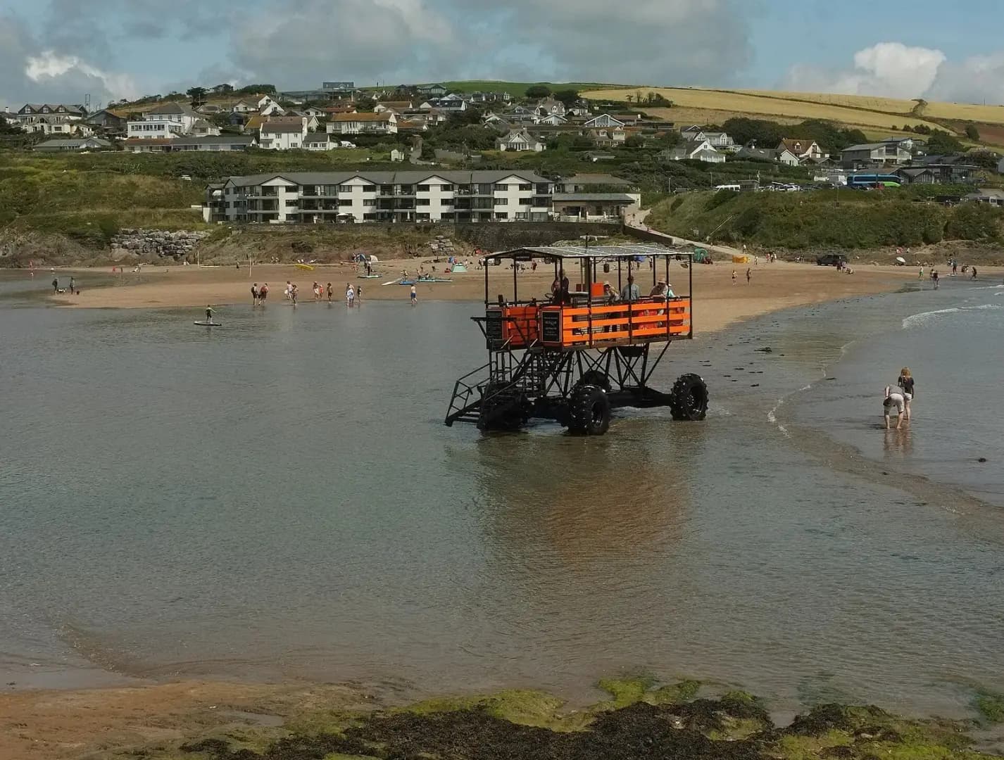
Sea tractor, Bigbury-on-Sea
Sea tractor, Bigbury-on-Sea. This photograph is used as a geographic witness to the place, not as evidence of the historical date shown in the chapter.
- Visual description
- Sea tractor, Bigbury-on-Sea
- Nature
- original
- Medium
- Open-licence photograph
- Source
- Wikimedia Commons / Geograph · CC BY-SA 2.0
- Reviewed
- Josh Wildman
THE TIDAL CROSSING
Bigbury-on-Sea
From farmland and fish cellars to a planned resort facing Burgh Island.
Scroll to follow the shoreline through time
Bigbury faces Burgh Island across a causeway covered by the tide.
That alternating connection and separation gives the beach its shape and makes access a visible daily event.
Sources for this chapter
BEFORE THE RESORT
Farms, fishing and the Pilchard Inn
In the nineteenth century the shore was mostly farming land, with fish cellars and a few buildings.
The Pilchard Inn preserves the island’s earlier connection to the local fishery.
Sources for this chapter
1908–1933
A holiday village is planned
The Bigbury Bay Land Company bought the area in 1908 and built a planned holiday village.
Steamers brought day visitors, motor traffic widened access and the Art Deco Burgh Island Hotel followed in the early 1930s.
Sources for this chapter
Open ledger · AOD.UK.BIGBURY.V01 · ORIGINALClose ledger · AOD.UK.BIGBURY.V01
Ledger AOD.UK.BIGBURY.V01
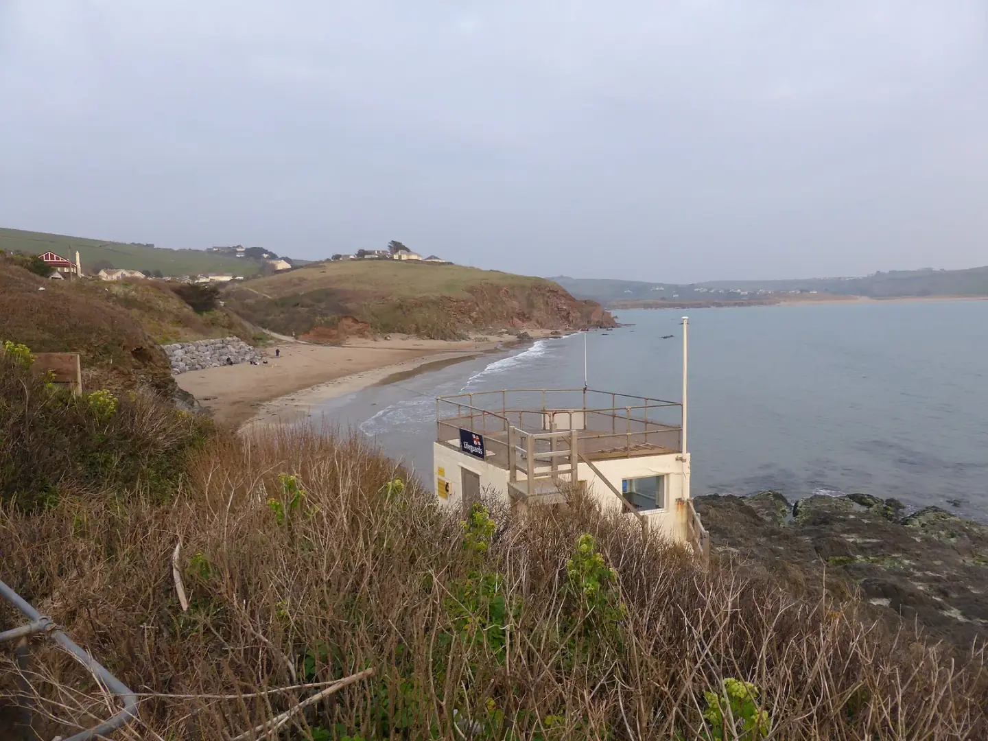
Beach at Bigbury-on-Sea
Beach at Bigbury-on-Sea. This photograph is used as a geographic witness to the place, not as evidence of the historical date shown in the chapter.
- Visual description
- Beach at Bigbury-on-Sea
- Nature
- original
- Medium
- Open-licence photograph
- Source
- Wikimedia Commons / Geograph · CC BY-SA 2.0
- Reviewed
- Josh Wildman
LATE 20th CENTURY
Surfing reads both sides of the island
As surfing spread through Devon, Bigbury offered beachbreak conditions shaped by the island, sand and Avon estuary.
The ride became one more use of a shore already engineered for leisure.
Sources for this chapter
THE LIVING MAP
The mapped place
Bigbury-on-Sea is recorded at 50.281° N, 3.888° W. A surf map fixes a name to one stretch of moving water, but the place changes with tide, swell direction, wind and the shape of the seabed.
Sources for this chapter
Open ledger · AOD.UK.BIGBURY.V00 · ORIGINALClose ledger · AOD.UK.BIGBURY.V00
Ledger AOD.UK.BIGBURY.V00
Sea tractor, Bigbury-on-Sea
Sea tractor, Bigbury-on-Sea. This photograph is used as a geographic witness to the place, not as evidence of the historical date shown in the chapter.
- Visual description
- Sea tractor, Bigbury-on-Sea
- Nature
- original
- Medium
- Open-licence photograph
- Source
- Wikimedia Commons / Geograph · CC BY-SA 2.0
- Reviewed
- Josh Wildman
TODAY
A resort still governed by the tide
Bigbury-on-Sea remains a visitor economy of beach businesses, holiday homes and coastal sport.
The island crossing prevents the place becoming ordinary: every day the tide redraws its main route.
Sources for this chapter
THE LEDGER
Sources and credits
This exhibition is built from local, institutional and sporting records. The source ledger keeps the claims visible and leaves space for correction as further local evidence emerges.
Sources for this chapter
Artefacts in order of appearance
Sea tractor, Bigbury-on-Sea
AOD.UK.BIGBURY.V00 · original · Wikimedia Commons / Geograph · CC BY-SA 2.0
Beach at Bigbury-on-Sea
AOD.UK.BIGBURY.V01 · original · Wikimedia Commons / Geograph · CC BY-SA 2.0
Editorial record
Full UK edition. Historical claims are linked to the local, public and sporting records used to write the exhibition. Cartography is generated from the PeakWave location catalogue.