Open ledger · AOD.US.BIG-BEAR.V00 · ORIGINALClose ledger · AOD.US.BIG-BEAR.V00
Ledger AOD.US.BIG-BEAR.V00
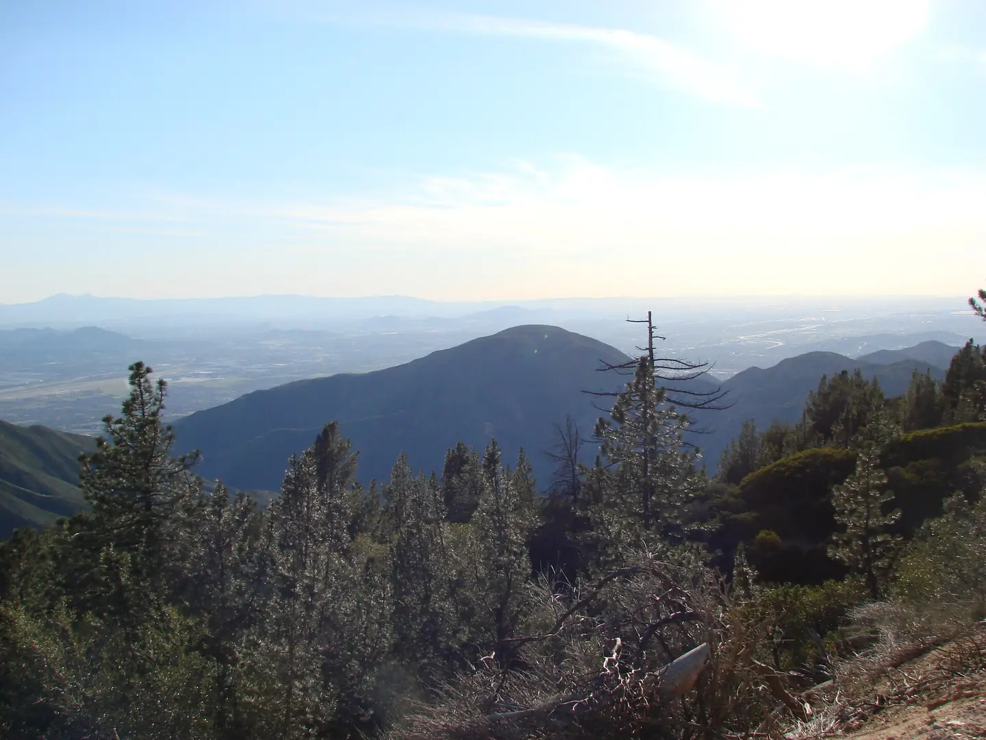
Big Bear Mountain - panoramio
Big Bear Mountain - panoramio. This photograph is used as a geographic witness to the place, not as evidence of the historical date shown in the chapter.
- Visual description
- Big Bear Mountain - panoramio
- Nature
- original
- Medium
- Open-licence photograph
- Source
- Wikimedia Commons · CC BY 3.0
BEFORE MODERN SPORT
Big Bear Mountain
How settlement, access and winter sport shaped Big Bear Mountain.
Scroll to read the contour through time
Big Bear Lake is a city in San Bernardino County, California, United States, located in the San Bernardino Mountains along the south shore of Big Bear Lake, and surrounded by the San Bernardino National Forest.
Sources for this chapter
1861
Work and settlement beneath the snowline
Once populated by only the natives and the grizzly bears, from which the area received its name, the population of the Big Bear Valley grew rapidly during the Southern California gold rush from 1861 to 1912.
Sources for this chapter
1921
A route reaches Big Bear Mountain
Emile Jesserun bought 40 acres (16 ha) of land that included the hot spring and built the first major resort in Big Bear, the Pan Hot Springs Hotel, in 1921.
Open ledger · AOD.US.BIG-BEAR.V01 · ORIGINALClose ledger · AOD.US.BIG-BEAR.V01
Ledger AOD.US.BIG-BEAR.V01
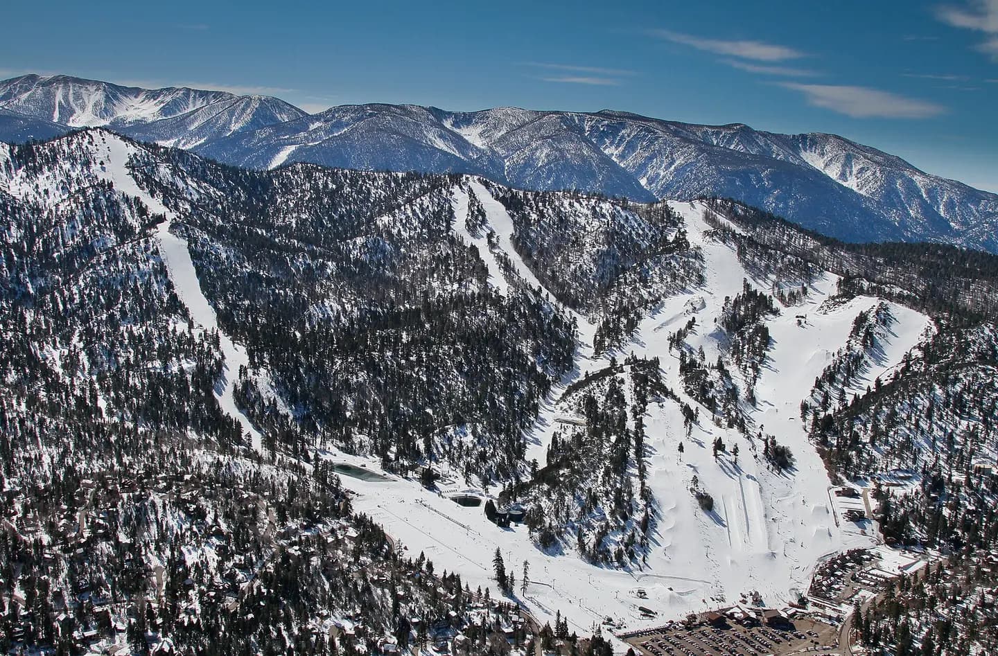
Bear Mountain, Big Bear Lake
Picture of the Bear Mountain Ski Resort in Big Bear Lake, CA. This photograph is used as a geographic witness to the place, not as evidence of the historical date shown in the chapter.
- Visual description
- Picture of the Bear Mountain Ski Resort in Big Bear Lake, CA
- Nature
- original
- Medium
- Open-licence photograph
- Source
- Wikimedia Commons · CC BY-SA 3.0
1932
Winter becomes organised
The local resort timeline records a Southern California tow rope in 1932, Moonridge Ski Area in 1943 and Snow Summit in 1952.
THE LIVING MAP
The mapped place
Big Bear Mountain is recorded at 34.236° N, 116.890° W. Its catalogue reference reaches 2,545 metres. A modern resort map compresses terrain, exposure and access into a diagram. This exhibition keeps the underlying contour visible so the place does not become only a list of facilities.
Sources for this chapter
Open ledger · AOD.US.BIG-BEAR.V00 · ORIGINALClose ledger · AOD.US.BIG-BEAR.V00
Ledger AOD.US.BIG-BEAR.V00
Big Bear Mountain - panoramio
Big Bear Mountain - panoramio. This photograph is used as a geographic witness to the place, not as evidence of the historical date shown in the chapter.
- Visual description
- Big Bear Mountain - panoramio
- Nature
- original
- Medium
- Open-licence photograph
- Source
- Wikimedia Commons · CC BY 3.0
TODAY
Big Bear Mountain now
Big Bear Lake remains a mountain town and Southern California winter destination, with skiing dependent on road access, elevation and extensive snowmaking.
THE LEDGER
Sources and credits
This exhibition is built from local, institutional and sporting records. The source ledger keeps the claims visible and leaves space for correction as further local evidence emerges.
Sources for this chapter
Artefacts in order of appearance
Big Bear Mountain - panoramio
AOD.US.BIG-BEAR.V00 · original · Wikimedia Commons · CC BY 3.0
Bear Mountain, Big Bear Lake
AOD.US.BIG-BEAR.V01 · original · Wikimedia Commons · CC BY-SA 3.0
Editorial record
Full US Beta edition. Place evidence is adapted from the linked Big Bear Lake, California overview under CC BY-SA 4.0 and remains subject to named historical and local review. Cartography is generated from the PeakWave location catalogue.