Open ledger · AOD.EU.BANSKO.V00 · ORIGINALClose ledger · AOD.EU.BANSKO.V00
Ledger AOD.EU.BANSKO.V00
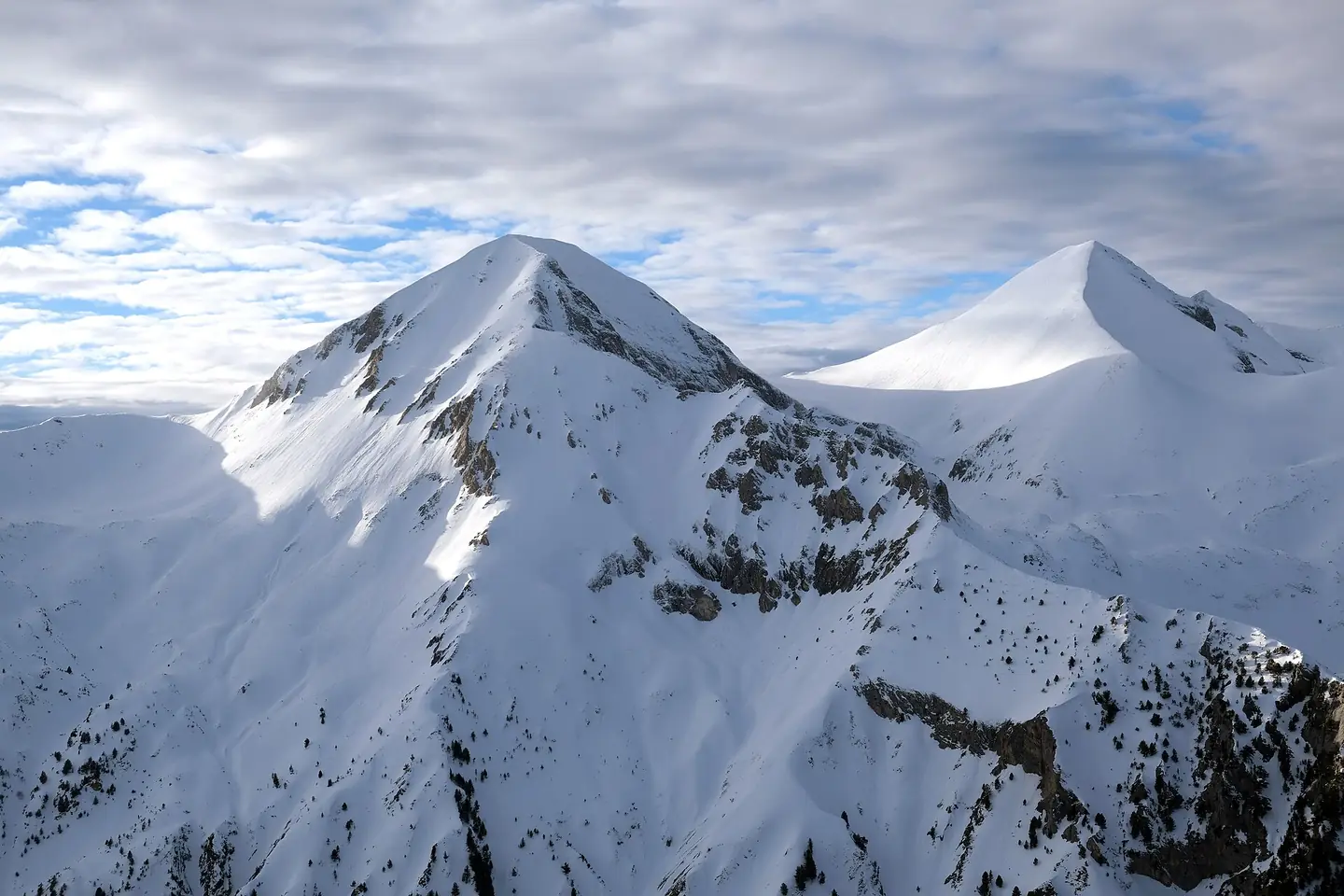
Vihren & Kutelo Pirin Mountains Bulgaria 2025
View of Vihren, the highest peak of Bulgaria's Pirin Mountains, from Bansko ski center. Kutelo peak on the right. This photograph is used as a geographic witness to the place, not as evidence of the historical date shown in the chapter.
- Visual description
- View of Vihren, the highest peak of Bulgaria's Pirin Mountains, from Bansko ski center. Kutelo peak on the right
- Nature
- original
- Medium
- Open-licence photograph
- Source
- Wikimedia Commons · CC BY-SA 4.0
BEFORE MODERN SPORT
Bansko
How settlement, access and winter sport shaped Bansko.
Scroll to read the contour through time
Bansko (Bulgarian: Банско ) is a town in southwestern Bulgaria, located in Blagoevgrad Oblast near the city of Razlog.
Sources for this chapter
1868
Work and settlement beneath the snowline
The Bulgarian Evangelical Church Community, the first Protestant church in Bulgaria, was founded in Bansko on 6 August 1868.
Sources for this chapter
2003
A route reaches Bansko
A gondola lift was built from town in 2003, replacing the minibus ride to the primary base area of Banderishka Poliana.
Sources for this chapter
Open ledger · AOD.EU.BANSKO.V01 · ORIGINALClose ledger · AOD.EU.BANSKO.V01
Ledger AOD.EU.BANSKO.V01
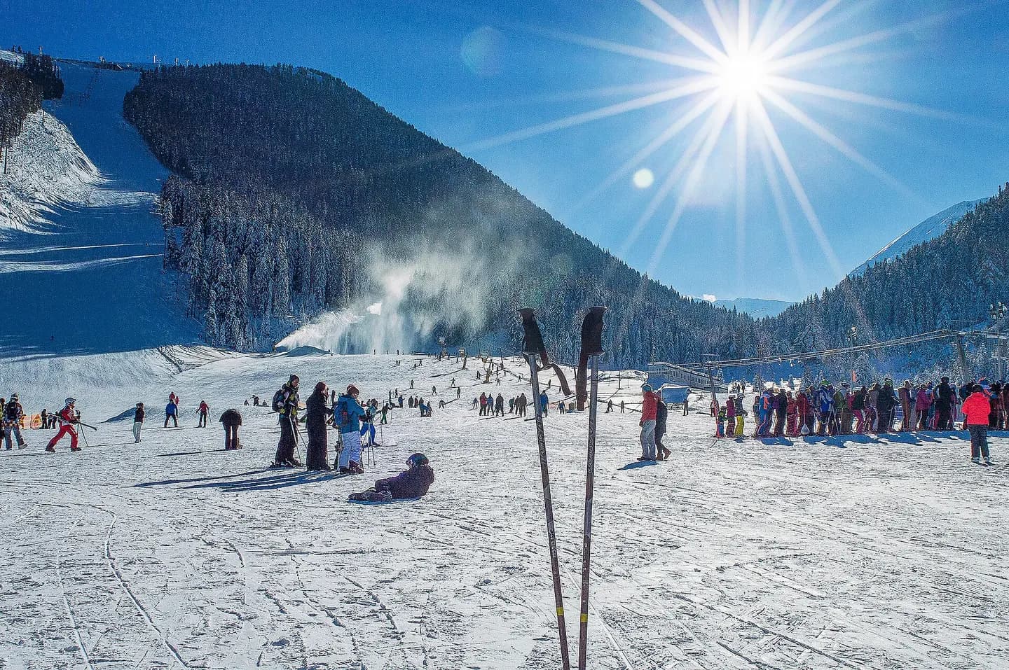
Ski zone Bansko
Banderishka meadow is an area in Pirin mountain near Bansko. We would be grateful if you give a link to our site - www.bdmundo.com ©Balcon del Mundo photo gallery | www.bdmundo.com/en/lzhnaya-zona-bansko/. This photograph is used as a geographic witness to the place, not as evidence of the historical date shown in the chapter.
- Visual description
- Banderishka meadow is an area in Pirin mountain near Bansko. We would be grateful if you give a link to our site - www.bdmundo.com ©Balcon del Mundo photo gallery | www.bdmundo.com/en/lzhnaya-zona-bansko/
- Nature
- original
- Medium
- Open-licence photograph
- Source
- Wikimedia Commons · CC BY-SA 2.0
2010
Winter becomes organised
As of 2010, the ski area has 75 km (47 mi) of ski runs, 14 lifts and drags, serving up to 24,500 persons per hour.
Sources for this chapter
THE LIVING MAP
The mapped place
Bansko is recorded at 41.814° N, 23.489° E. Its catalogue reference reaches 2,560 metres. A modern resort map compresses terrain, exposure and access into a diagram. This exhibition keeps the underlying contour visible so the place does not become only a list of facilities.
Sources for this chapter
Open ledger · AOD.EU.BANSKO.V00 · ORIGINALClose ledger · AOD.EU.BANSKO.V00
Ledger AOD.EU.BANSKO.V00
Vihren & Kutelo Pirin Mountains Bulgaria 2025
View of Vihren, the highest peak of Bulgaria's Pirin Mountains, from Bansko ski center. Kutelo peak on the right. This photograph is used as a geographic witness to the place, not as evidence of the historical date shown in the chapter.
- Visual description
- View of Vihren, the highest peak of Bulgaria's Pirin Mountains, from Bansko ski center. Kutelo peak on the right
- Nature
- original
- Medium
- Open-licence photograph
- Source
- Wikimedia Commons · CC BY-SA 4.0
TODAY
Bansko now
Bansko has recently hosted FIS World Cup alpine ski races: the women race in 2009 in two downhills and a super-G.
Sources for this chapter
THE LEDGER
Sources and credits
This exhibition is built from local, institutional and sporting records. The source ledger keeps the claims visible and leaves space for correction as further local evidence emerges.
Sources for this chapter
Artefacts in order of appearance
Vihren & Kutelo Pirin Mountains Bulgaria 2025
AOD.EU.BANSKO.V00 · original · Wikimedia Commons · CC BY-SA 4.0
Ski zone Bansko
AOD.EU.BANSKO.V01 · original · Wikimedia Commons · CC BY-SA 2.0
Editorial record
Full European Beta edition. Place evidence is adapted from the linked Bansko overview under CC BY-SA 4.0 and remains subject to named historical and local review. Cartography is generated from the PeakWave location catalogue.