Open ledger · AOD.EU.BAKURIANI.V00 · ORIGINALClose ledger · AOD.EU.BAKURIANI.V00
Ledger AOD.EU.BAKURIANI.V00
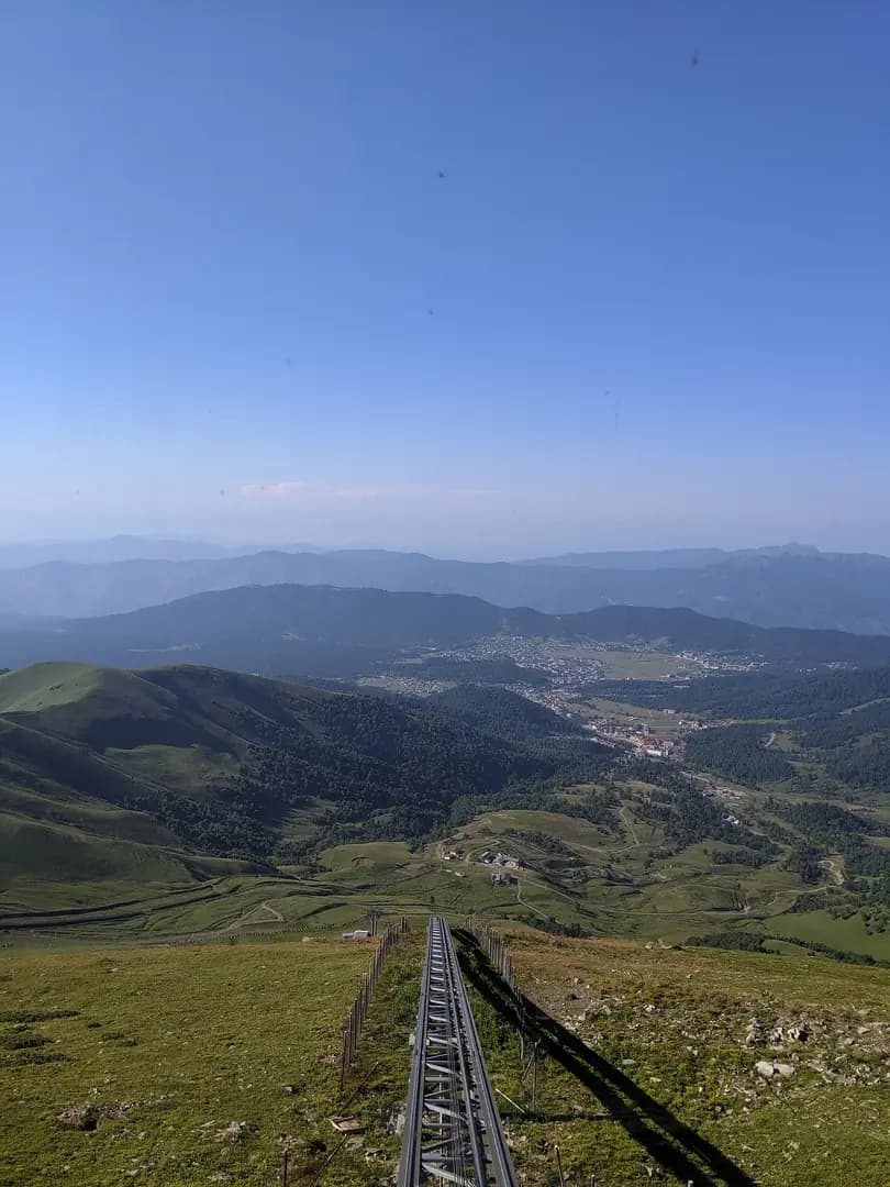
Bakuriani town as seen from Didveli lift
View from the top "Didveli Panorama" funicular (2702m elevation) in summer 2019, looking down at the town of Bakuriani and surrounding mountains. This photograph is used as a geographic witness to the place, not as evidence of the historical date shown in the chapter.
- Visual description
- View from the top "Didveli Panorama" funicular (2702m elevation) in summer 2019, looking down at the town of Bakuriani and surrounding mountains
- Nature
- original
- Medium
- Open-licence photograph
- Source
- Wikimedia Commons · CC BY-SA 4.0
BEFORE MODERN SPORT
Bakuriani
How settlement, access and winter sport shaped Bakuriani.
Scroll to read the contour through time
Bakuriani (Georgian: ბაკურიანი) is a daba and a ski resort in the Borjomi district of Georgia.
Sources for this chapter
BEFORE TOURISM
Work and settlement beneath the snowline
He lived in Bakuriani for much of his life, and the street he lived on was named in his honour after his death.
Sources for this chapter
ACCESS CHANGES
A route reaches Bakuriani
Mount Kokhta provides a maximum skiable altitude of 2,269 metres (7,444 ft), whereas the highest lift in Didveli reaches 2,702 metres (8,865 ft).
Sources for this chapter
Open ledger · AOD.EU.BAKURIANI.V01 · ORIGINALClose ledger · AOD.EU.BAKURIANI.V01
Ledger AOD.EU.BAKURIANI.V01
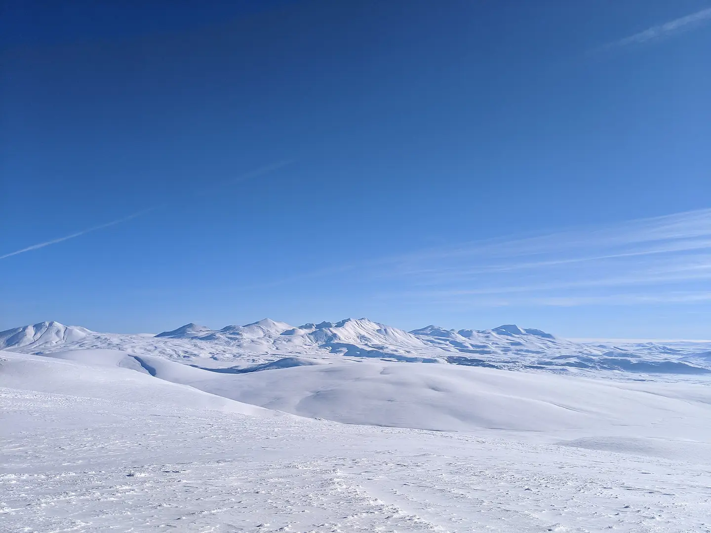
View of Ktsia-Tabatskuri Managed Reserve
Photograph of snow-capped mountains in the Ktsia-Tabatskuri Managed Reserve. Taken from the top of the highest ski lift accessible in the Bakuriani ski resort in late December 2018. This photograph is used as a geographic witness to the place, not as evidence of the historical date shown in the chapter.
- Visual description
- Photograph of snow-capped mountains in the Ktsia-Tabatskuri Managed Reserve. Taken from the top of the highest ski lift accessible in the Bakuriani ski resort in late December 2018
- Nature
- original
- Medium
- Open-licence photograph
- Source
- Wikimedia Commons · CC BY-SA 4.0
ORGANISED SPORT
Winter becomes organised
The ski area of the resort is split into two separate parts: Didveli and Kokhta/Kokhta-Mitarbi.
Sources for this chapter
THE LIVING MAP
The mapped place
Bakuriani is recorded at 41.750° N, 43.529° E. Its catalogue reference reaches 2,702 metres. A modern resort map compresses terrain, exposure and access into a diagram. This exhibition keeps the underlying contour visible so the place does not become only a list of facilities.
Sources for this chapter
Open ledger · AOD.EU.BAKURIANI.V00 · ORIGINALClose ledger · AOD.EU.BAKURIANI.V00
Ledger AOD.EU.BAKURIANI.V00
Bakuriani town as seen from Didveli lift
View from the top "Didveli Panorama" funicular (2702m elevation) in summer 2019, looking down at the town of Bakuriani and surrounding mountains. This photograph is used as a geographic witness to the place, not as evidence of the historical date shown in the chapter.
- Visual description
- View from the top "Didveli Panorama" funicular (2702m elevation) in summer 2019, looking down at the town of Bakuriani and surrounding mountains
- Nature
- original
- Medium
- Open-licence photograph
- Source
- Wikimedia Commons · CC BY-SA 4.0
TODAY
Bakuriani now
In 2023, the Georgian Ski Association organised there the 2023 FIS Freestyle Ski and Snowboarding World Championships.
Sources for this chapter
THE LEDGER
Sources and credits
This exhibition is built from local, institutional and sporting records. The source ledger keeps the claims visible and leaves space for correction as further local evidence emerges.
Sources for this chapter
Artefacts in order of appearance
Bakuriani town as seen from Didveli lift
AOD.EU.BAKURIANI.V00 · original · Wikimedia Commons · CC BY-SA 4.0
View of Ktsia-Tabatskuri Managed Reserve
AOD.EU.BAKURIANI.V01 · original · Wikimedia Commons · CC BY-SA 4.0
Editorial record
Full European Beta edition. Place evidence is adapted from the linked Bakuriani overview under CC BY-SA 4.0 and remains subject to named historical and local review. Cartography is generated from the PeakWave location catalogue.