Open ledger · AOD.US.ASPEN.V00 · ORIGINALClose ledger · AOD.US.ASPEN.V00
Ledger AOD.US.ASPEN.V00
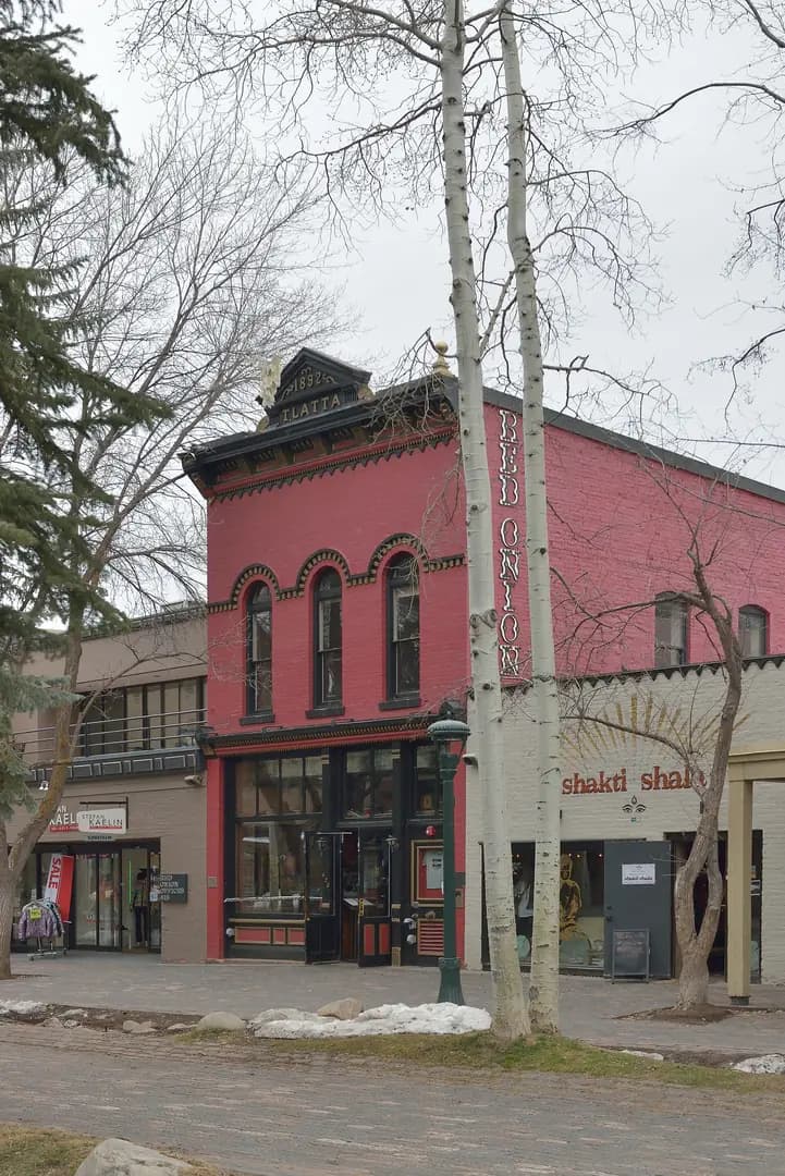
Aspen Colorado E Cooper avenue
E Cooper avenue in Aspen, Colorado. This photograph is used as a geographic witness to the place, not as evidence of the historical date shown in the chapter.
- Visual description
- E Cooper avenue in Aspen, Colorado
- Nature
- original
- Medium
- Open-licence photograph
- Source
- Wikimedia Commons · CC BY-SA 3.0
BEFORE MODERN SPORT
Aspen
How settlement, access and winter sport shaped Aspen.
Scroll to read the contour through time
Aspen is the home rule city that is the county seat of, and the most populous municipality in, Pitkin County, Colorado, United States.
Sources for this chapter
BEFORE TOURISM
Work and settlement beneath the snowline
Founded as a mining camp during the Colorado Silver Boom and later named Aspen for the abundance of aspen trees in the area, the city boomed during the 1880s, its first decade.
Sources for this chapter
ACCESS CHANGES
A route reaches Aspen
In the same week, the Denver and Rio Grande completed its line into Aspen, becoming the first railroad to provide direct rail service to the town.
Open ledger · AOD.US.ASPEN.V01 · ORIGINALClose ledger · AOD.US.ASPEN.V01
Ledger AOD.US.ASPEN.V01
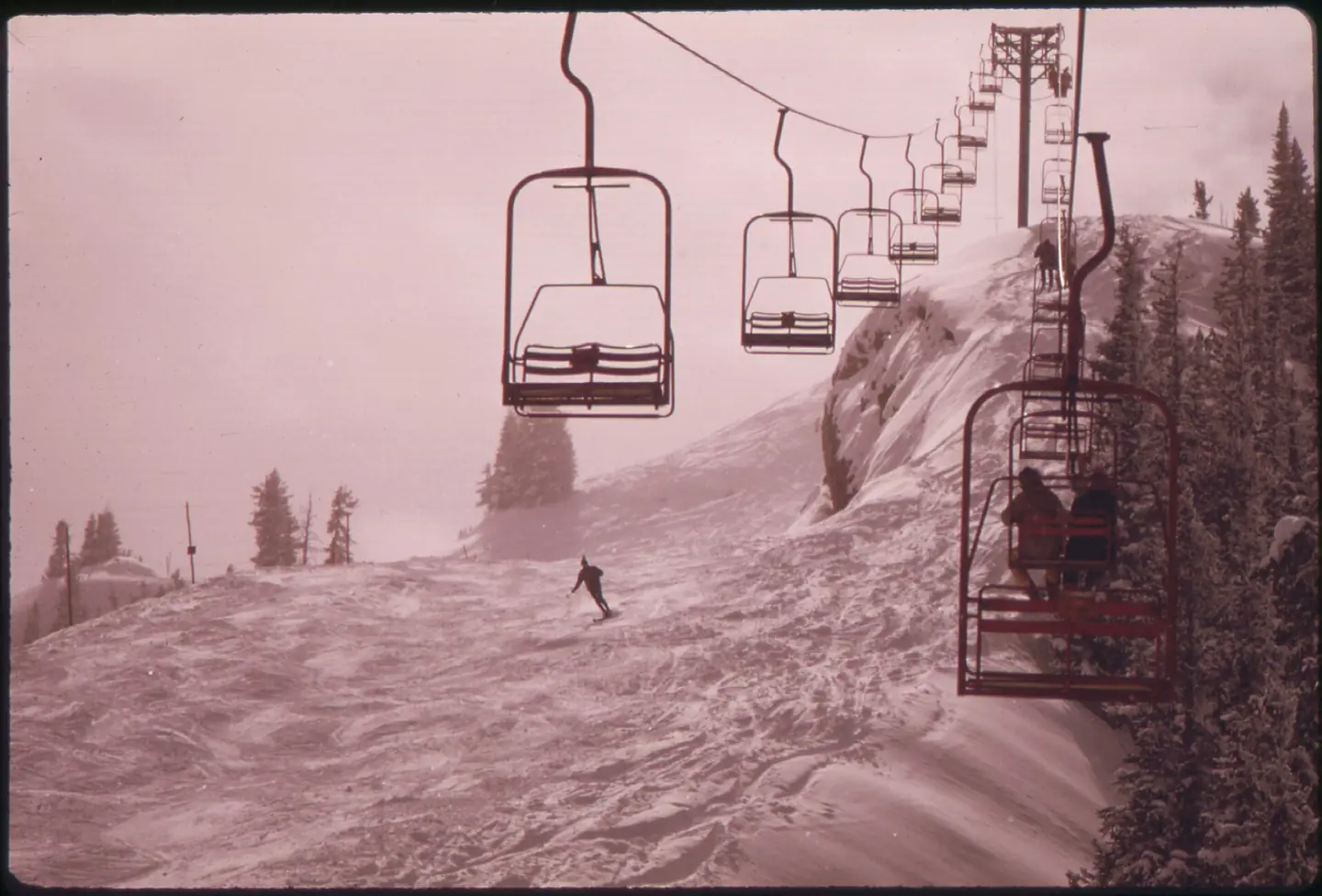
ALL THE LIFTS AT ASPEN ARE CHAIRLIFTS. THIS ONE IS GOING UP 11,800 FEET ON ASPEN HIGHLANDS MOUNTAIN, HIGHEST SKI AREA... - NARA - 554248
All the lifts at aspen are chairlifts. This one is going up 11,800 feet on Aspen Highlands Mountain, highest ski area at Aspen. This photograph is used as a geographic witness to the place, not as evidence of the historical date shown in the chapter.
- Visual description
- All the lifts at aspen are chairlifts. This one is going up 11,800 feet on Aspen Highlands Mountain, highest ski area at Aspen
- Nature
- original
- Medium
- Open-licence photograph
- Source
- Wikimedia Commons · Public domain
1947
Winter becomes organised
Aspen Mountain formally opened for lift-served skiing on 11 January 1947 after skiing had already taken place on the surrounding slopes.
THE LIVING MAP
The mapped place
Aspen is recorded at 39.191° N, 106.817° W. Its catalogue reference reaches 3,418 metres. A modern resort map compresses terrain, exposure and access into a diagram. This exhibition keeps the underlying contour visible so the place does not become only a list of facilities.
Sources for this chapter
Open ledger · AOD.US.ASPEN.V00 · ORIGINALClose ledger · AOD.US.ASPEN.V00
Ledger AOD.US.ASPEN.V00
Aspen Colorado E Cooper avenue
E Cooper avenue in Aspen, Colorado. This photograph is used as a geographic witness to the place, not as evidence of the historical date shown in the chapter.
- Visual description
- E Cooper avenue in Aspen, Colorado
- Nature
- original
- Medium
- Open-licence photograph
- Source
- Wikimedia Commons · CC BY-SA 3.0
TODAY
Aspen now
Aspen is now both an international ski destination and a year-round cultural centre, while its nineteenth-century mining street plan remains visible below the mountain.
THE LEDGER
Sources and credits
This exhibition is built from local, institutional and sporting records. The source ledger keeps the claims visible and leaves space for correction as further local evidence emerges.
Sources for this chapter
Artefacts in order of appearance
Aspen Colorado E Cooper avenue
AOD.US.ASPEN.V00 · original · Wikimedia Commons · CC BY-SA 3.0
ALL THE LIFTS AT ASPEN ARE CHAIRLIFTS. THIS ONE IS GOING UP 11,800 FEET ON ASPEN HIGHLANDS MOUNTAIN, HIGHEST SKI AREA... - NARA - 554248
AOD.US.ASPEN.V01 · original · Wikimedia Commons · Public domain
Editorial record
Full US Beta edition. Place evidence is adapted from the linked Aspen, Colorado overview under CC BY-SA 4.0 and remains subject to named historical and local review. Cartography is generated from the PeakWave location catalogue.