Open ledger · AOD.EU.ARABBA.V00 · ORIGINALClose ledger · AOD.EU.ARABBA.V00
Ledger AOD.EU.ARABBA.V00
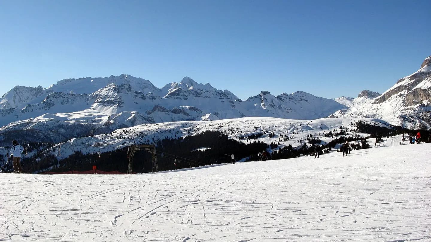
With Sas Cherz view Ski resort Arabba-Marmolada - panoramio
With Sas Cherz view Ski resort Arabba/Marmolada. This photograph is used as a geographic witness to the place, not as evidence of the historical date shown in the chapter.
- Visual description
- With Sas Cherz view Ski resort Arabba/Marmolada
- Nature
- original
- Medium
- Open-licence photograph
- Source
- Wikimedia Commons · CC BY-SA 3.0
BEFORE MODERN SPORT
Arabba-Marmolada
How settlement, access and winter sport shaped Arabba-Marmolada.
Scroll to read the contour through time
Livinallongo del Col di Lana (pronounced ; Ladin: Fodóm; German: Buchenstein) is a comune (municipality) in the Province of Belluno in the Italian region Veneto, located about 120 kilometres (75 mi) north of Venice and about 45 kilometres (28 mi) northwest of Belluno.
Sources for this chapter
BEFORE TOURISM
Before the resort map
The linked local overview does not preserve a clear account of Arabba-Marmolada before modern tourism.
This edition leaves that part of the timeline open rather than mistaking the first surviving sporting reference for the beginning of the place.
Sources for this chapter
ACCESS CHANGES
A route reaches Arabba-Marmolada
The surviving overview does not identify one decisive access date for Arabba-Marmolada.
This edition therefore leaves that date open rather than turning gradual change into a false single event.
Sources for this chapter
Open ledger · AOD.EU.ARABBA.V01 · ORIGINALClose ledger · AOD.EU.ARABBA.V01
Ledger AOD.EU.ARABBA.V01
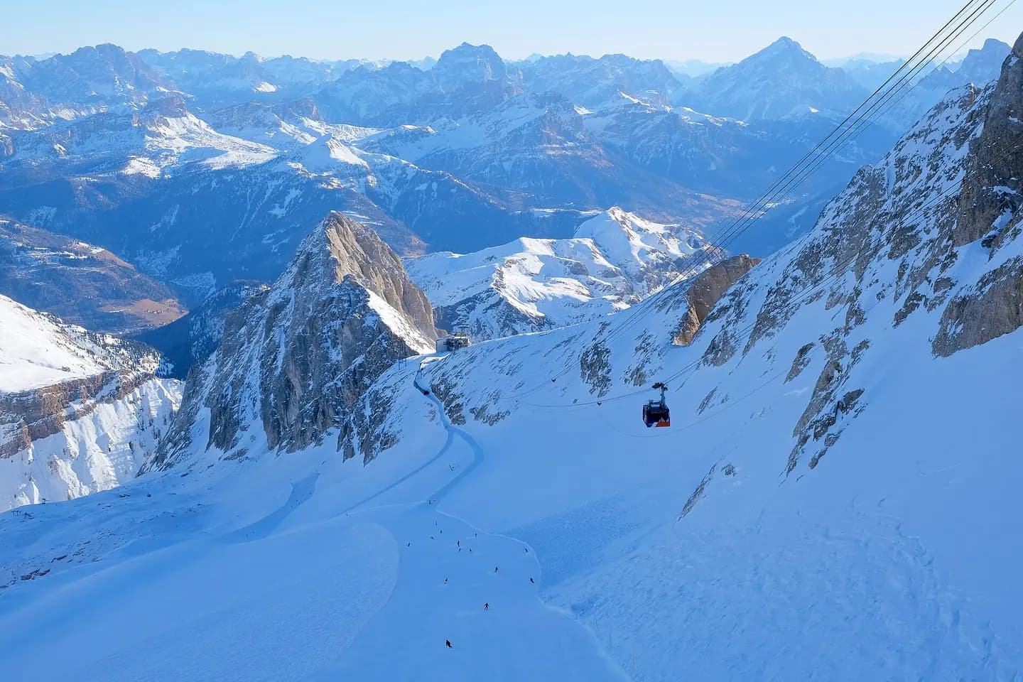
Marmolada + Sellaronda tour 3
La Bellunese ski slope from Punta Rocca, Arabba/Marmolada ski resort. On the right side is the cableway Serauta - Punta Rocca. This photograph is used as a geographic witness to the place, not as evidence of the historical date shown in the chapter.
- Visual description
- La Bellunese ski slope from Punta Rocca, Arabba/Marmolada ski resort. On the right side is the cableway Serauta - Punta Rocca
- Nature
- original
- Medium
- Open-licence photograph
- Source
- Wikimedia Commons · CC BY-SA 4.0
1975
Winter becomes organised
The area consists of 16 ski areas spread over 12 resorts: Cortina d'Ampezzo Plan de Corones/Kronplatz Alta Badia Val Gardena/Gröden Alpe di Siusi/Seiser Alm Val di Fassa Carezza Arabba Marmolada Tre Cime (since 1975) Val di Fiemme (since 1976) Obereggen (since 1976) San Martino di Castrozza – Rolle Pass (since 1976) Rio Pusteria – Bressanone/Brixen (since 1979) Alpe Lusia – San Pellegrino (since 1984) Civetta (since 1993) The Sella Ronda and Gardena Ronda and other major ski circuits are located within the resort.
THE LIVING MAP
The mapped place
Arabba-Marmolada is recorded at 46.497° N, 11.874° E. Its catalogue reference reaches 3,265 metres. A modern resort map compresses terrain, exposure and access into a diagram. This exhibition keeps the underlying contour visible so the place does not become only a list of facilities.
Sources for this chapter
Open ledger · AOD.EU.ARABBA.V00 · ORIGINALClose ledger · AOD.EU.ARABBA.V00
Ledger AOD.EU.ARABBA.V00
With Sas Cherz view Ski resort Arabba-Marmolada - panoramio
With Sas Cherz view Ski resort Arabba/Marmolada. This photograph is used as a geographic witness to the place, not as evidence of the historical date shown in the chapter.
- Visual description
- With Sas Cherz view Ski resort Arabba/Marmolada
- Nature
- original
- Medium
- Open-licence photograph
- Source
- Wikimedia Commons · CC BY-SA 3.0
TODAY
Arabba-Marmolada now
Ninety percent of the population speak Ladin as their native language.
Sources for this chapter
THE LEDGER
Sources and credits
This exhibition is built from local, institutional and sporting records. The source ledger keeps the claims visible and leaves space for correction as further local evidence emerges.
Sources for this chapter
Artefacts in order of appearance
With Sas Cherz view Ski resort Arabba-Marmolada - panoramio
AOD.EU.ARABBA.V00 · original · Wikimedia Commons · CC BY-SA 3.0
Marmolada + Sellaronda tour 3
AOD.EU.ARABBA.V01 · original · Wikimedia Commons · CC BY-SA 4.0
Editorial record
Full European Beta edition. Place evidence is adapted from the linked Livinallongo del Col di Lana overview under CC BY-SA 4.0 and remains subject to named historical and local review. Cartography is generated from the PeakWave location catalogue.