Open ledger · AOD.EU.ANDERMATT.V00 · ORIGINALClose ledger · AOD.EU.ANDERMATT.V00
Ledger AOD.EU.ANDERMATT.V00
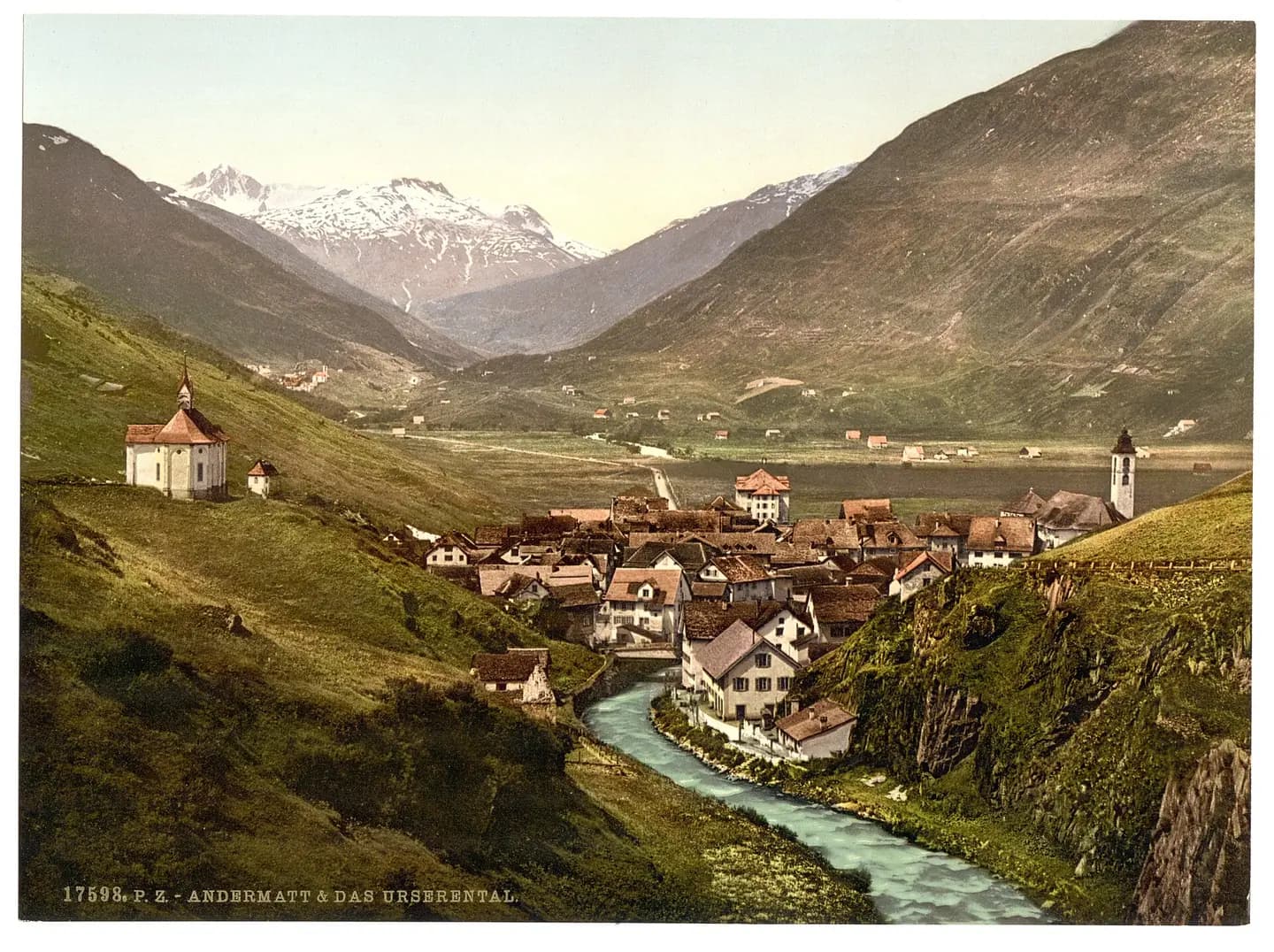
The Ursern Valley, Andermatt, Switzerland-LCCN2001701094
Forms part of: Views of Switzerland in the Photochrom print collection.; Title from the Detroit Publishing Co., Catalogue J-foreign section, Detroit, Mich. : Detroit Publishing Company, 1905.; Print no. "17598". This photograph is used as a geographic witness to the place, not as evidence of the historical date shown in the chapter.
- Visual description
- Forms part of: Views of Switzerland in the Photochrom print collection.; Title from the Detroit Publishing Co., Catalogue J-foreign section, Detroit, Mich. : Detroit Publishing Company, 1905.; Print no. "17598"
- Nature
- original
- Medium
- Open-licence photograph
- Source
- Wikimedia Commons · Public domain
BEFORE MODERN SPORT
Andermatt
How settlement, access and winter sport shaped Andermatt.
Scroll to read the contour through time
Andermatt (Romansh: ) is a mountain village and municipality in the canton of Uri in Switzerland.
Sources for this chapter
BEFORE TOURISM
Work and settlement beneath the snowline
Of the rest of the land, 1.7% is settled (buildings or roads) and the remainder (52%) is non-productive (rivers, glaciers or mountains).
Sources for this chapter
1881
A route reaches Andermatt
However the opening in 1881 of the St Gotthard railway tunnel reversed the village's fortunes, as the tunnel runs immediately beneath it, connecting the Central Swiss town of Göschenen with Airolo in Ticino.
Sources for this chapter
Open ledger · AOD.EU.ANDERMATT.V01 · ORIGINALClose ledger · AOD.EU.ANDERMATT.V01
Ledger AOD.EU.ANDERMATT.V01
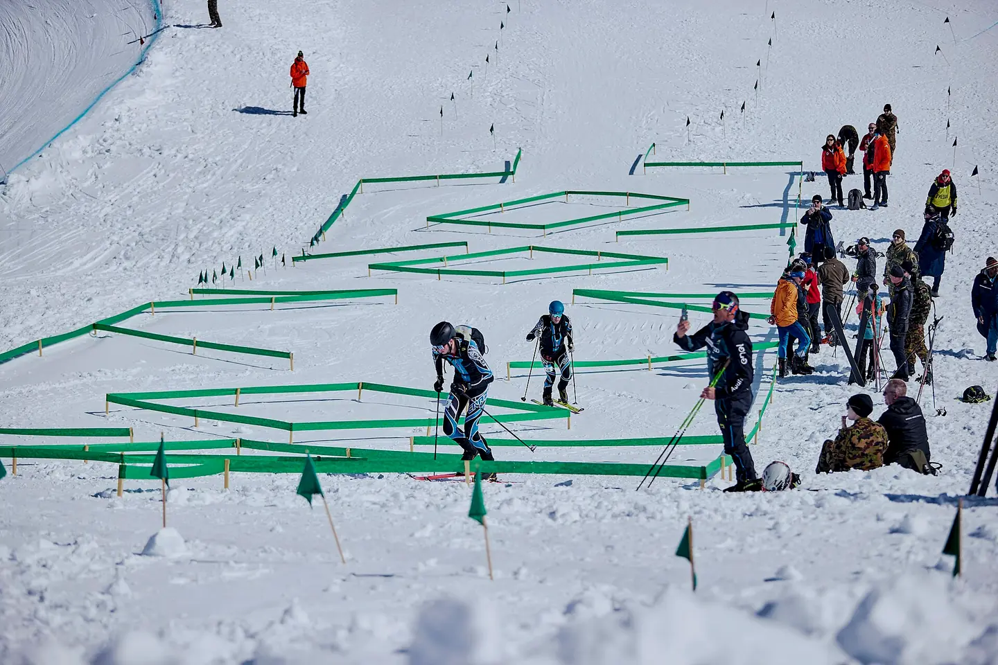
CISM 2025 World Winter Military Games
CISM 2025 World Winter Military Games. This photograph is used as a geographic witness to the place, not as evidence of the historical date shown in the chapter.
- Visual description
- CISM 2025 World Winter Military Games
- Nature
- original
- Medium
- Open-licence photograph
- Source
- Wikimedia Commons · Public domain
ORGANISED SPORT
Winter becomes organised
By the turn of the 21st century, as an alternative to the expensive ski resorts St Moritz and Gstaad, Andermatt steadily expanded its ski resort.
Sources for this chapter
THE LIVING MAP
The mapped place
Andermatt is recorded at 46.633° N, 8.594° E. Its catalogue reference reaches 2,963 metres. A modern resort map compresses terrain, exposure and access into a diagram. This exhibition keeps the underlying contour visible so the place does not become only a list of facilities.
Sources for this chapter
Open ledger · AOD.EU.ANDERMATT.V00 · ORIGINALClose ledger · AOD.EU.ANDERMATT.V00
Ledger AOD.EU.ANDERMATT.V00
The Ursern Valley, Andermatt, Switzerland-LCCN2001701094
Forms part of: Views of Switzerland in the Photochrom print collection.; Title from the Detroit Publishing Co., Catalogue J-foreign section, Detroit, Mich. : Detroit Publishing Company, 1905.; Print no. "17598". This photograph is used as a geographic witness to the place, not as evidence of the historical date shown in the chapter.
- Visual description
- Forms part of: Views of Switzerland in the Photochrom print collection.; Title from the Detroit Publishing Co., Catalogue J-foreign section, Detroit, Mich. : Detroit Publishing Company, 1905.; Print no. "17598"
- Nature
- original
- Medium
- Open-licence photograph
- Source
- Wikimedia Commons · Public domain
TODAY
Andermatt now
There are plans to overhaul the ski areas, and connect Nätschen with the neighbouring slopes of Oberalp, which are currently only accessible by train, however they are a part of the whole ski area.
Sources for this chapter
THE LEDGER
Sources and credits
This exhibition is built from local, institutional and sporting records. The source ledger keeps the claims visible and leaves space for correction as further local evidence emerges.
Sources for this chapter
Artefacts in order of appearance
The Ursern Valley, Andermatt, Switzerland-LCCN2001701094
AOD.EU.ANDERMATT.V00 · original · Wikimedia Commons · Public domain
CISM 2025 World Winter Military Games
AOD.EU.ANDERMATT.V01 · original · Wikimedia Commons · Public domain
Editorial record
Full European Beta edition. Place evidence is adapted from the linked Andermatt overview under CC BY-SA 4.0 and remains subject to named historical and local review. Cartography is generated from the PeakWave location catalogue.