Open ledger · AOD.EU.ALPE-DHUEZ.V00 · ORIGINALClose ledger · AOD.EU.ALPE-DHUEZ.V00
Ledger AOD.EU.ALPE-DHUEZ.V00
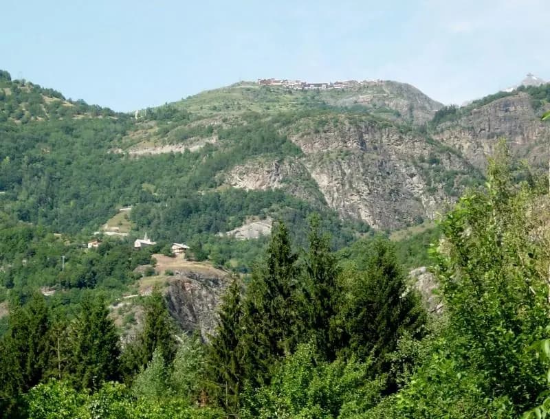
Alpe D'Huez from bottom - France
Looking towards Alpe D'Huez from the parking lot in Le Bourg d'Oisan. The ski town can be seen at the top, the church in La Garde can be seen about a third of the way up, but the switchbacks and suffering are hardly visible from here. This photograph is used as a geographic witness to the place, not as evidence of the historical date shown in the chapter.
- Visual description
- Looking towards Alpe D'Huez from the parking lot in Le Bourg d'Oisan. The ski town can be seen at the top, the church in La Garde can be seen about a third of the way up, but the switchbacks and suffering are hardly visible from here
- Nature
- original
- Medium
- Open-licence photograph
- Source
- Wikimedia Commons · CC BY-SA 2.0
BEFORE MODERN SPORT
Alpe d'Huez
How settlement, access and winter sport shaped Alpe d'Huez.
Scroll to read the contour through time
L'Alpe d'Huez is a ski resort in Southeastern France at 1,250 to 3,330 metres (4,100 to 10,925 ft).
Sources for this chapter
BEFORE TOURISM
Work and settlement beneath the snowline
The medieval mining operation stretched from Gua (the Sarenne Valley) to the Lac Blanc (Massif des Rousses).
Sources for this chapter
1936
A route reaches Alpe d'Huez
This is where the first platter lift for skiers was opened in 1936 with perches by Jean Pomagalski, creator of the Poma company.
Sources for this chapter
Open ledger · AOD.EU.ALPE-DHUEZ.V01 · ORIGINALClose ledger · AOD.EU.ALPE-DHUEZ.V01
Ledger AOD.EU.ALPE-DHUEZ.V01
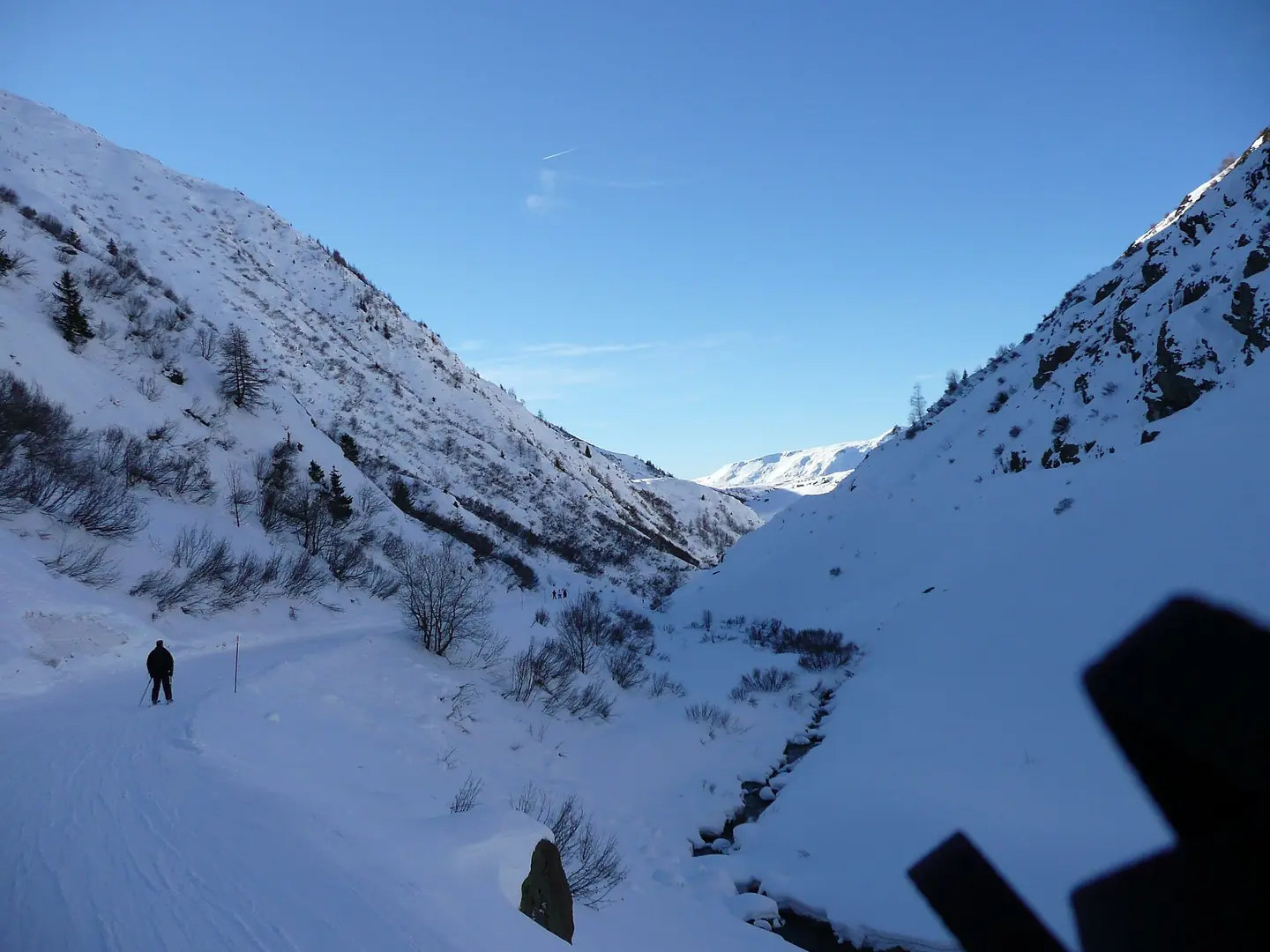
Montagne 014
Piste Sarenne Alpe d'Huez. This photograph is used as a geographic witness to the place, not as evidence of the historical date shown in the chapter.
- Visual description
- Piste Sarenne Alpe d'Huez
- Nature
- original
- Medium
- Open-licence photograph
- Source
- Wikimedia Commons · CC BY-SA 3.0
ORGANISED SPORT
Winter becomes organised
With 249 kilometres (155 miles) of piste and 84 ski lifts, the resort is now one of the world's largest.
Sources for this chapter
THE LIVING MAP
The mapped place
Alpe d'Huez is recorded at 45.092° N, 6.068° E. Its catalogue reference reaches 3,330 metres. A modern resort map compresses terrain, exposure and access into a diagram. This exhibition keeps the underlying contour visible so the place does not become only a list of facilities.
Sources for this chapter
Open ledger · AOD.EU.ALPE-DHUEZ.V00 · ORIGINALClose ledger · AOD.EU.ALPE-DHUEZ.V00
Ledger AOD.EU.ALPE-DHUEZ.V00
Alpe D'Huez from bottom - France
Looking towards Alpe D'Huez from the parking lot in Le Bourg d'Oisan. The ski town can be seen at the top, the church in La Garde can be seen about a third of the way up, but the switchbacks and suffering are hardly visible from here. This photograph is used as a geographic witness to the place, not as evidence of the historical date shown in the chapter.
- Visual description
- Looking towards Alpe D'Huez from the parking lot in Le Bourg d'Oisan. The ski town can be seen at the top, the church in La Garde can be seen about a third of the way up, but the switchbacks and suffering are hardly visible from here
- Nature
- original
- Medium
- Open-licence photograph
- Source
- Wikimedia Commons · CC BY-SA 2.0
TODAY
Alpe d'Huez now
The expansion of the skiing above the linked resorts of Vaujany, Oz-en-Oisans, Villard Reculas and Auris boosted the quantity and quality of intermediate grade slopes but the resort is mostly known for freeskiing, drawing many steep skiing enthusiasts to its high altitude terrain.
Sources for this chapter
THE LEDGER
Sources and credits
This exhibition is built from local, institutional and sporting records. The source ledger keeps the claims visible and leaves space for correction as further local evidence emerges.
Sources for this chapter
Artefacts in order of appearance
Alpe D'Huez from bottom - France
AOD.EU.ALPE-DHUEZ.V00 · original · Wikimedia Commons · CC BY-SA 2.0
Montagne 014
AOD.EU.ALPE-DHUEZ.V01 · original · Wikimedia Commons · CC BY-SA 3.0
Editorial record
Full European Beta edition. Place evidence is adapted from the linked Alpe d'Huez overview under CC BY-SA 4.0 and remains subject to named historical and local review. Cartography is generated from the PeakWave location catalogue.