Open ledger · AOD.EU.AARHUS.V00 · ORIGINALClose ledger · AOD.EU.AARHUS.V00
Ledger AOD.EU.AARHUS.V00
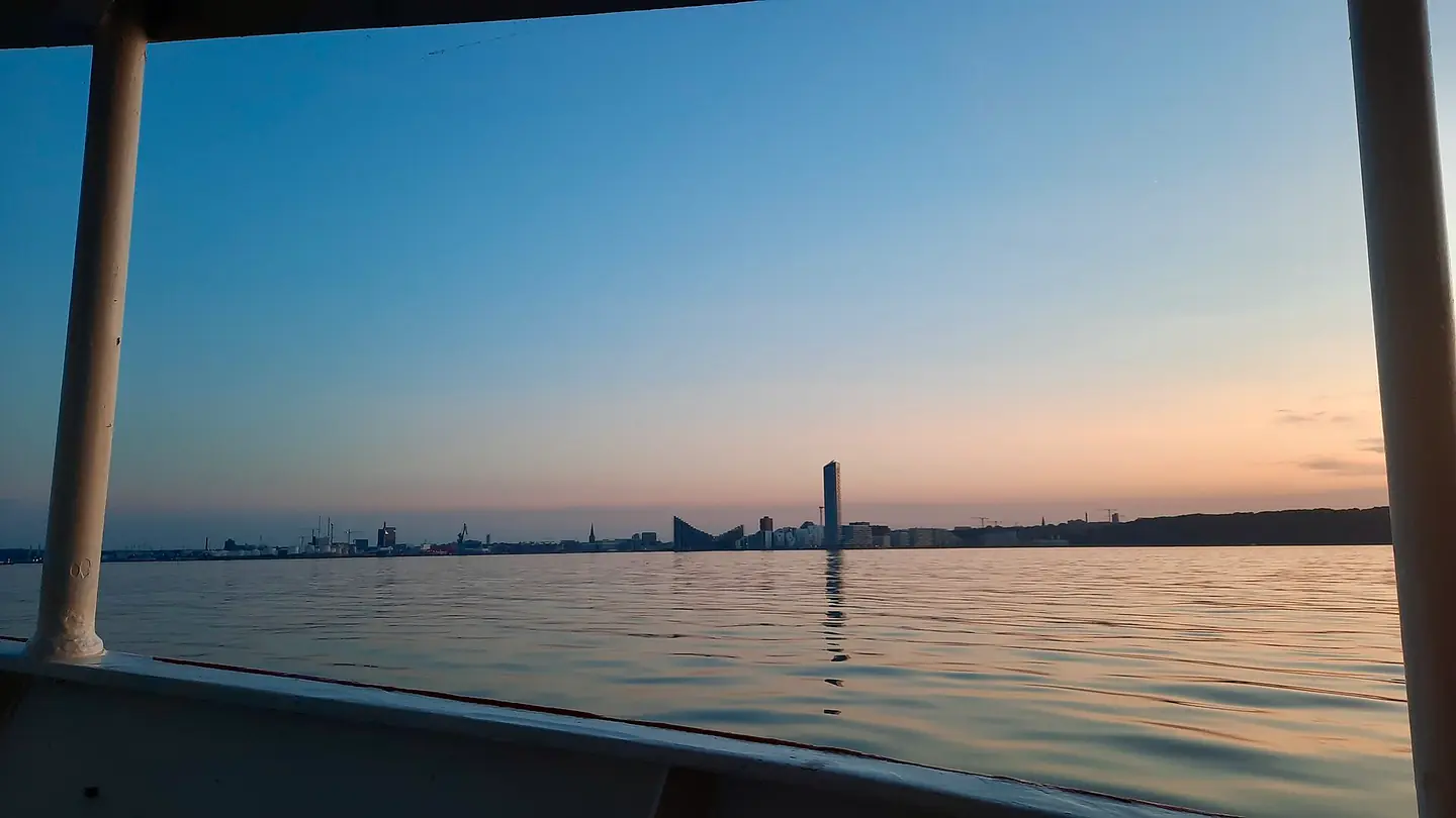
Lighthouse and Aarhus Ø Docklands seen from boat June sunset Denmark 02
Lighthouse and Aarhus Ø Docklands seen from boat June sunset Denmark 02. This photograph is used as a geographic witness to the place, not as evidence of the historical date shown in the chapter.
- Visual description
- Lighthouse and Aarhus Ø Docklands seen from boat June sunset Denmark 02
- Nature
- original
- Medium
- Open-licence photograph
- Source
- Wikimedia Commons · CC BY-SA 4.0
BEFORE MODERN SPORT
Aarhus
How working water, access and organised sailing shaped Aarhus.
Scroll to read the water through time
Aarhus (, US also ; Danish: , locally also ) is the second-largest city in Denmark and the seat of Aarhus Municipality.
Sources for this chapter
1928
A working shore
In 1928, the first university in Jutland was founded in Aarhus and today it is a university city and the largest centre for trade, services, industry, and tourism in Jutland.
Sources for this chapter
2017
The route to the water
Aarhus Letbane is a local electric tram-train system that opened in December 2017, connecting the central station and the inner city with the University Hospital in Skejby and also replaced local railway services to Grenaa and Odder in late 2018.
Sources for this chapter
Open ledger · AOD.EU.AARHUS.V01 · ORIGINALClose ledger · AOD.EU.AARHUS.V01
Ledger AOD.EU.AARHUS.V01
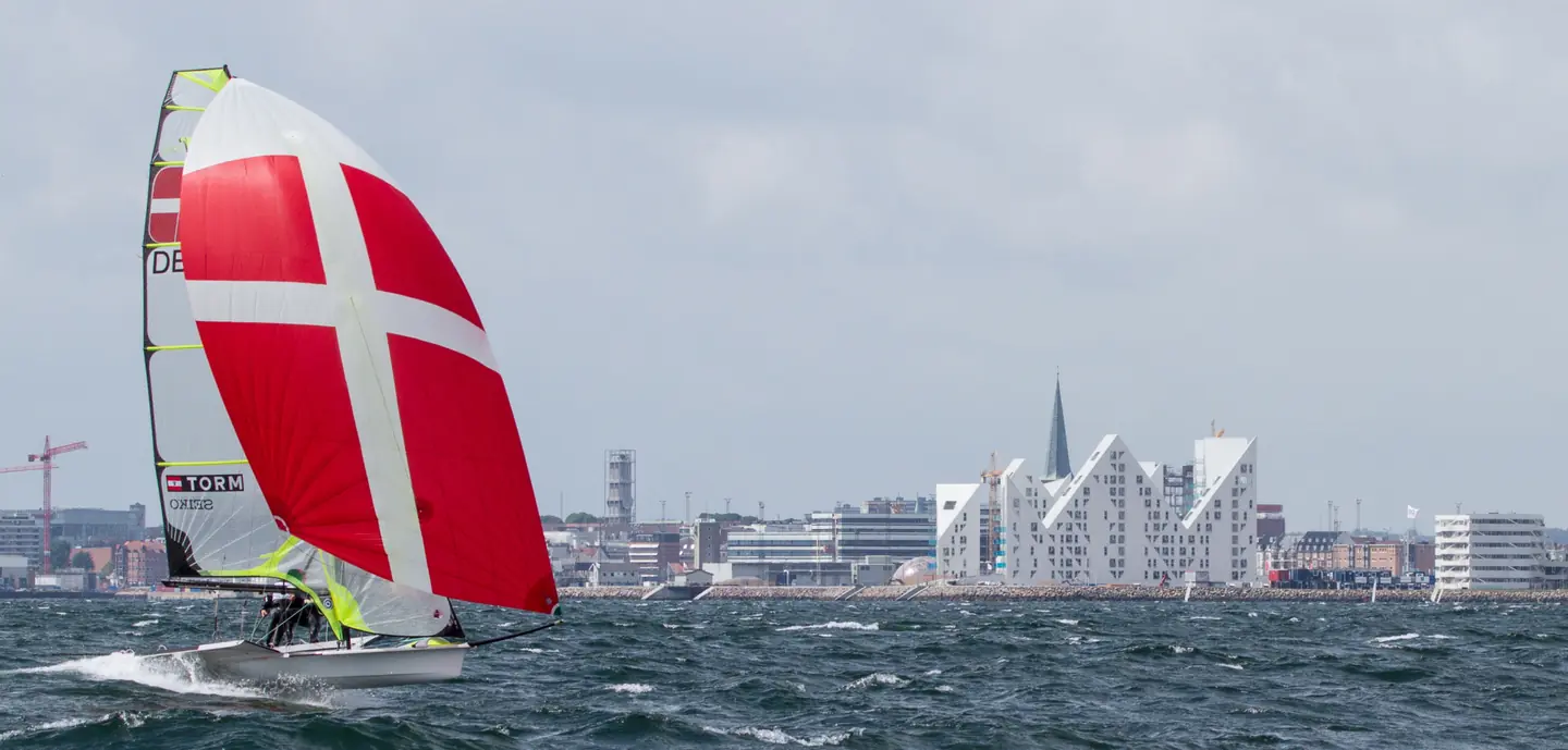
Sailing at Aarhus Bay
Aarhus Bay, 2014, Isbjerget in the background. This photograph is used as a geographic witness to the place, not as evidence of the historical date shown in the chapter.
- Visual description
- Aarhus Bay, 2014, Isbjerget in the background
- Nature
- original
- Medium
- Open-licence photograph
- Source
- Wikimedia Commons · CC BY-SA 4.0
2008
Sailing becomes organised
In 2008, the city hosted the ISAF Youth Sailing World Championships and in 2018 it was host to the ISAF Sailing World Championships, the world championship for the 12 Olympic sailing disciplines.
Sources for this chapter
THE LIVING MAP
The mapped place
Aarhus is recorded at 56.150° N, 10.220° E as a coastal open venue. A course drawn here is temporary: wind, current, shore and marks determine the water that sailors actually meet.
Sources for this chapter
Open ledger · AOD.EU.AARHUS.V00 · ORIGINALClose ledger · AOD.EU.AARHUS.V00
Ledger AOD.EU.AARHUS.V00
Lighthouse and Aarhus Ø Docklands seen from boat June sunset Denmark 02
Lighthouse and Aarhus Ø Docklands seen from boat June sunset Denmark 02. This photograph is used as a geographic witness to the place, not as evidence of the historical date shown in the chapter.
- Visual description
- Lighthouse and Aarhus Ø Docklands seen from boat June sunset Denmark 02
- Nature
- original
- Medium
- Open-licence photograph
- Source
- Wikimedia Commons · CC BY-SA 4.0
TODAY
Aarhus now
Watersports like sailing, kayaking, motor boating, etc.
are also popular, and since the bay rarely freezes up in winter, they can also be practised most of the year.
Sources for this chapter
THE LEDGER
Sources and credits
This exhibition is built from local, institutional and sporting records. The source ledger keeps the claims visible and leaves space for correction as further local evidence emerges.
Sources for this chapter
Artefacts in order of appearance
Lighthouse and Aarhus Ø Docklands seen from boat June sunset Denmark 02
AOD.EU.AARHUS.V00 · original · Wikimedia Commons · CC BY-SA 4.0
Sailing at Aarhus Bay
AOD.EU.AARHUS.V01 · original · Wikimedia Commons · CC BY-SA 4.0
Editorial record
Full European Beta edition. Place evidence is adapted from the linked Aarhus overview under CC BY-SA 4.0 and remains subject to named historical and local review. Cartography is generated from the PeakWave location catalogue.